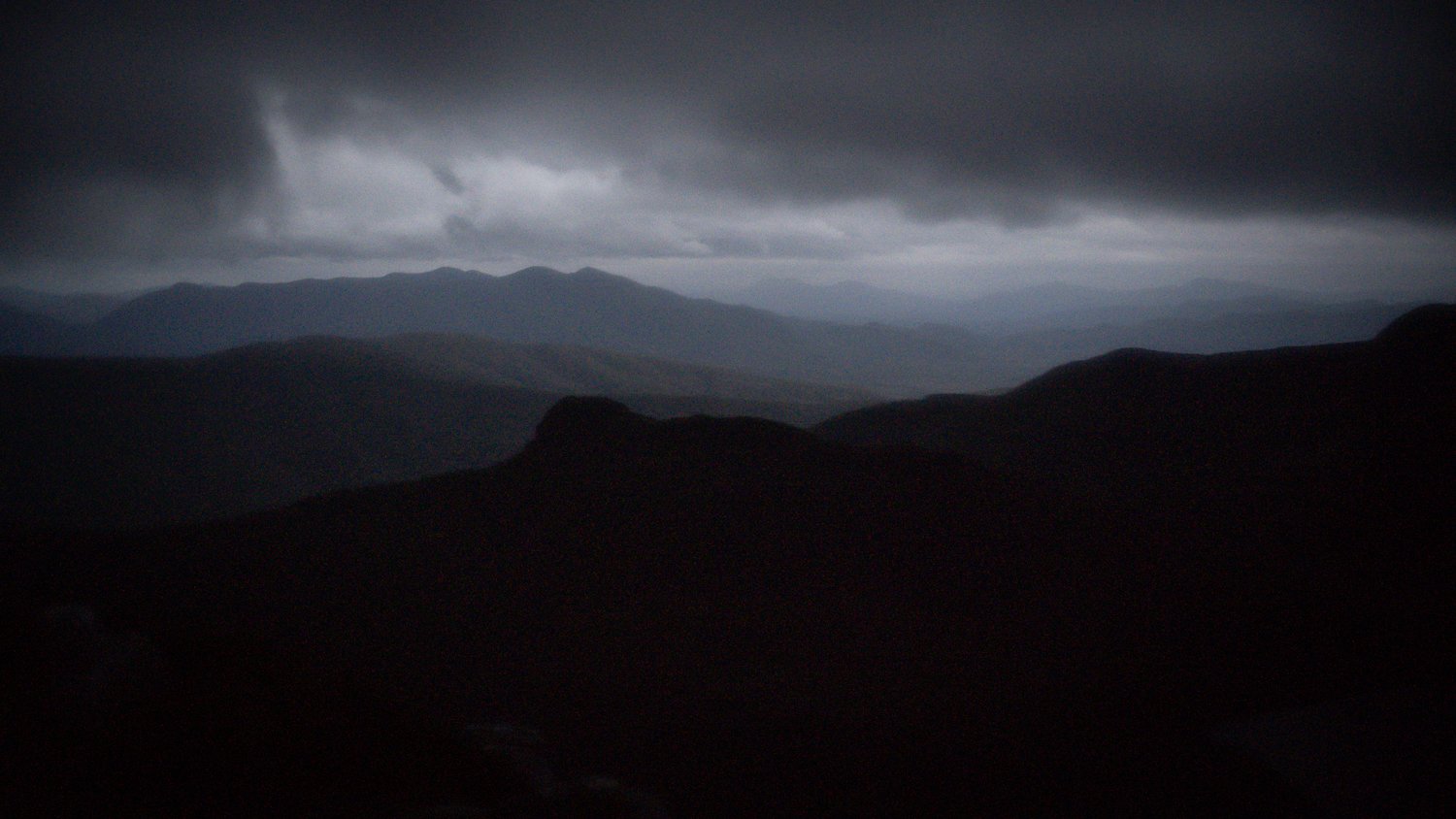
The Western Arthurs Range, South West Tasmania
A-K In A Day - A Tale Of Mates, Mountains & Mud
Intro
From John Chapmans website:
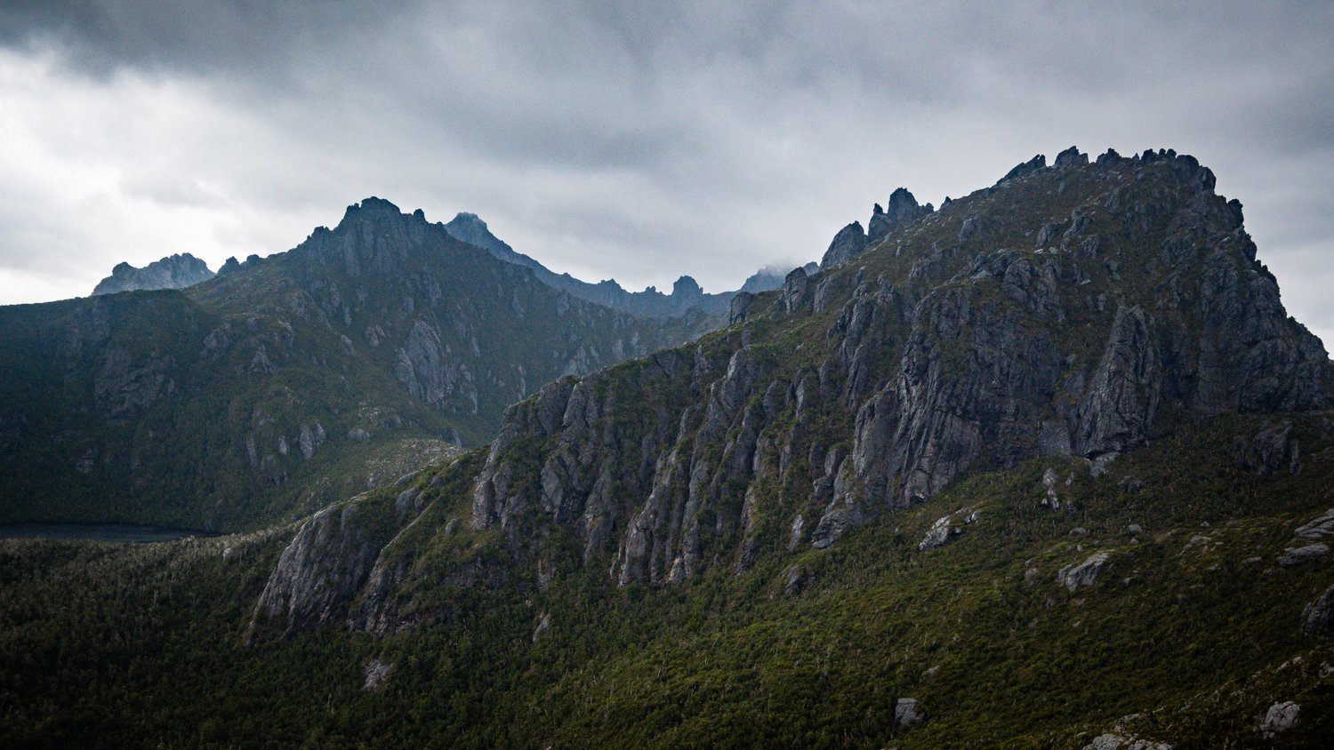
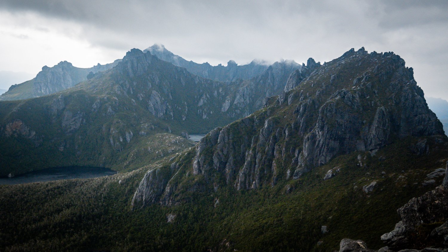
The Western Arthurs is a small mountain range in South West Tasmania. The range was heavily glaciated during recent ice ages and is an almost continuous series of steep cirque headwalls. While it is only 15km long, the range contains 22 major peaks and 30 lakes. The scenery is spectacular with glacial tarns surrounded by towering cliffs. The range is the best example of glaciated scenery in Tasmania (and Australia).
The Western Arthurs is the most obvious range in South West Tasmania and as such was an early attraction. The higher peaks were probably regularly climbed by the aborigines. The first recorded ascent of the range was by Robinson in 1830 and he climbed Mt Hayes with the assistance of the aborigines. The early explorers and bushwalkers climbed the main peaks many times from the plains. Some walkers wondered if a traverse of the crest of the range was possible and in December 1960 the first full traverse of the Western Arthur Range was completed.
From the Tasmanian Parks & Wildlife Website:
“The challenges of the walk are not to be underestimated, and should be completed only by walkers with significant experience in remote, alpine conditions.
To traverse the rugged Western Arthur Range is considered a major bushwalking challenge and has been undertaken regularly by experienced bushwalkers since the 1960s. Located in Southwest National Park, and part of the Tasmanian Wilderness World Heritage Area (TWWHA), the 69 kilometer Western Arthur Range Traverse covers extensive, rugged topography and funnels walkers through narrow corridors throughout much of the range.
The landscape that contributes to the area's World Heritage values is made up of steep slopes, alpine moorlands and glacial lakes. The ranges are a geological delight, composed almost exclusively of deformed Precambrian quartzite and quartz schist. Walkers will mainly journey through alpine heath and alpine scrub vegetation. Elsewhere, buttongrass heath is widespread and scrub, wet forest and patches of rainforest occur on the lower slopes.
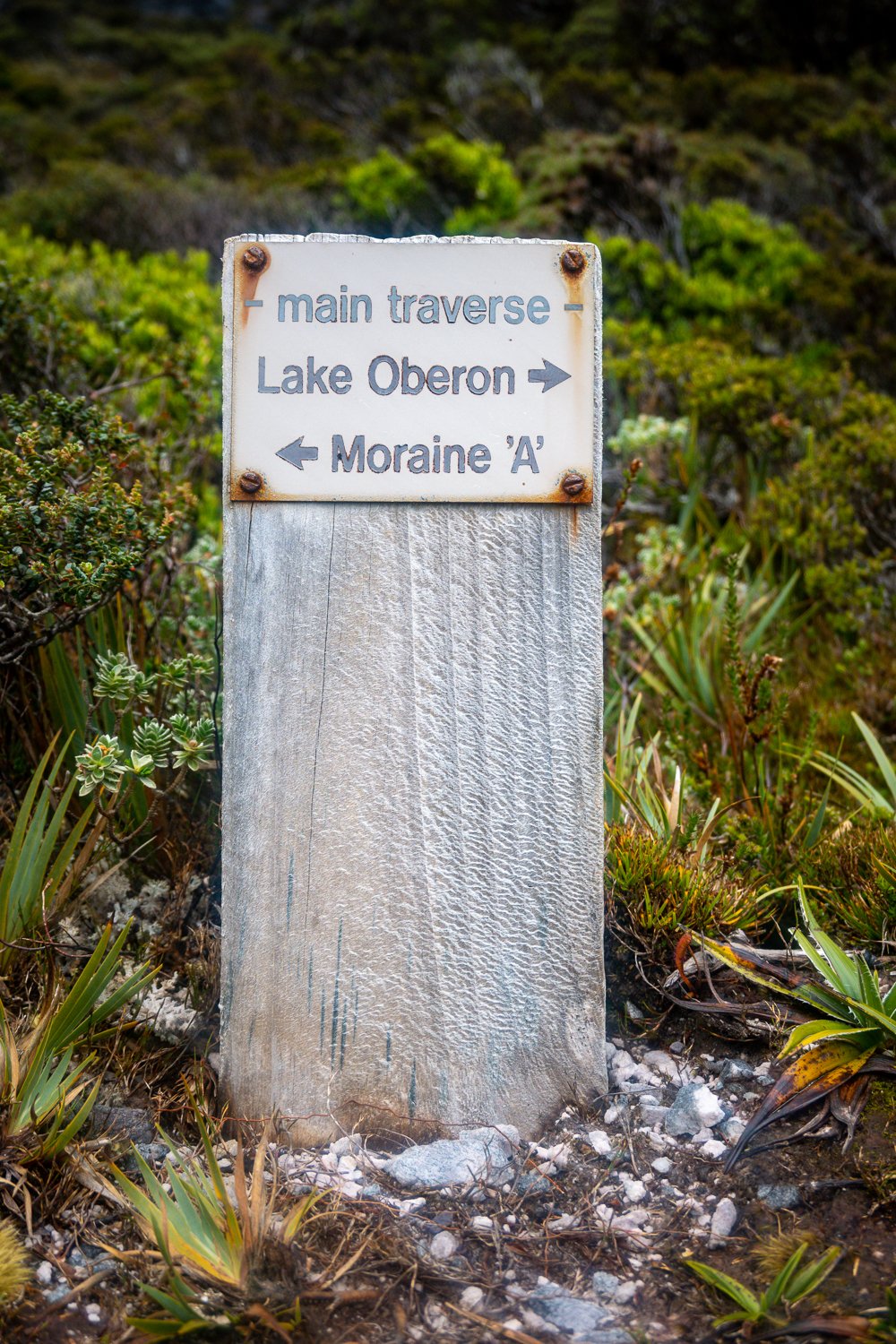
The Western Arthur Range Traverse can be experienced through a range of walk lengths. Those wanting to traverse the entire range will need between 10 to 12 days to complete the circuit. Others may decide to traverse from Alpha Moraine to Kappa Moraine in 5 to 7 days. Those only wishing to walk into Lake Oberon and back will need to set aside 3 to 4 days.”

‘Let’s Go That Way”
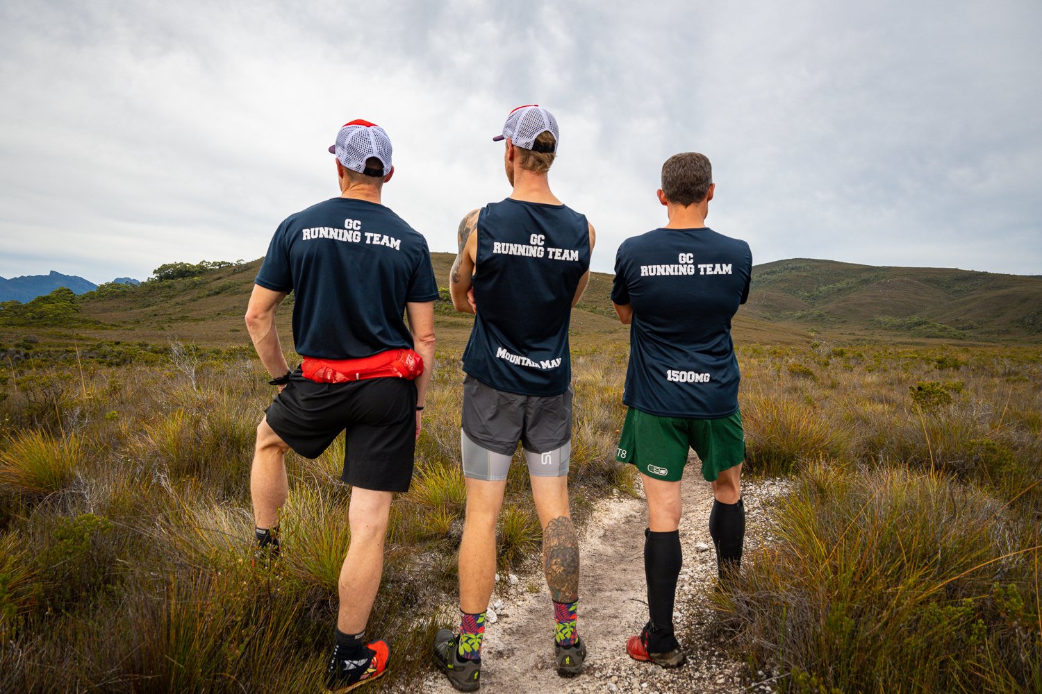
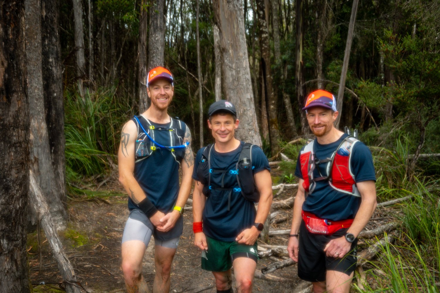
At 7:00am on the 15 April 2023, the GC Running Team, which consists of Jon Minnebo ‘Mountain Man’, Francois Fourie ‘The Champ’ and myself ‘#1500mg’, set on an adventure into the wild southwest of Tasmania that would see us start at Scotts Peak carpark, traverse the Western Arthurs Range from Moraine A - K and finish back at the carpark. All up it should be 60km which we thought may take around 18hrs.
To most people this sounds either dumb, crazy or both. To us, this was the best fun you can have on two legs.
It all began 5 years earlier when I saw a Strava post of the circuit completed by a friend of mine, Lincoln Quilliam. Lincoln and another well-known Tassie Trail runner, Piotr Babis completed the mission by starting and finishing at Junction Creek which is about 9k in from the carpark. By camping at Junction creek, you get a nice 40km round trip.
Due to family and work commitments, it was hard to find an extra night so we decided to attempt the circuit by starting and finishing at the carpark. The day started a bit late, we slept in by an hour due to an alarm not going off. This was really unlike our crew, normally there would be multiple alarms, and everyone would be up and ready to go. For some reason that didn’t happen this time and that goes down as ‘Lesson #1’. One of the prices paid for sleeping in was missing an epic sunrise, we saw it through the trees and for a couple of photographers that was a nice little slap on the wrist.
However, spirits were high and with loads of laughs and a dose of nervous tension we were soon on the trail. A mix of thoughts filled my mind; am I capable of this, maybe I am biting off more than I can chew, this will be awesome, of course you can… Round and round the merry go went. The old head, heart and soul having a battle, but the soul won out and my desire pushed my legs into action and off we set!
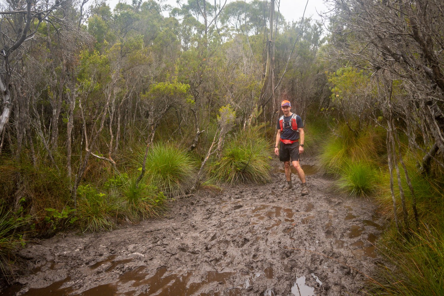
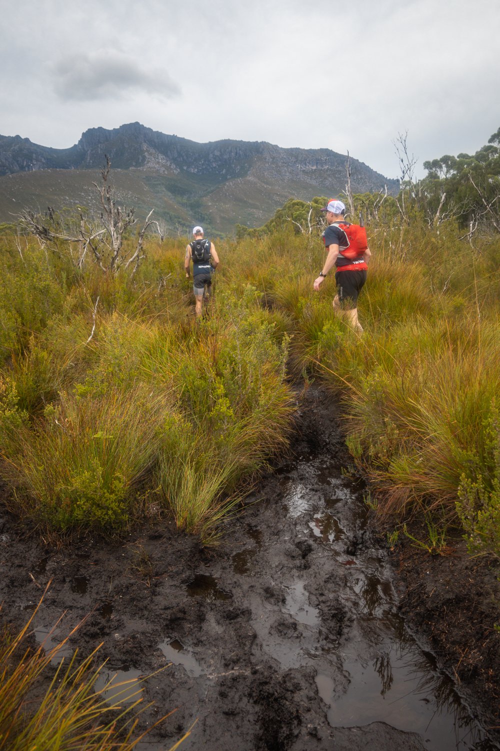
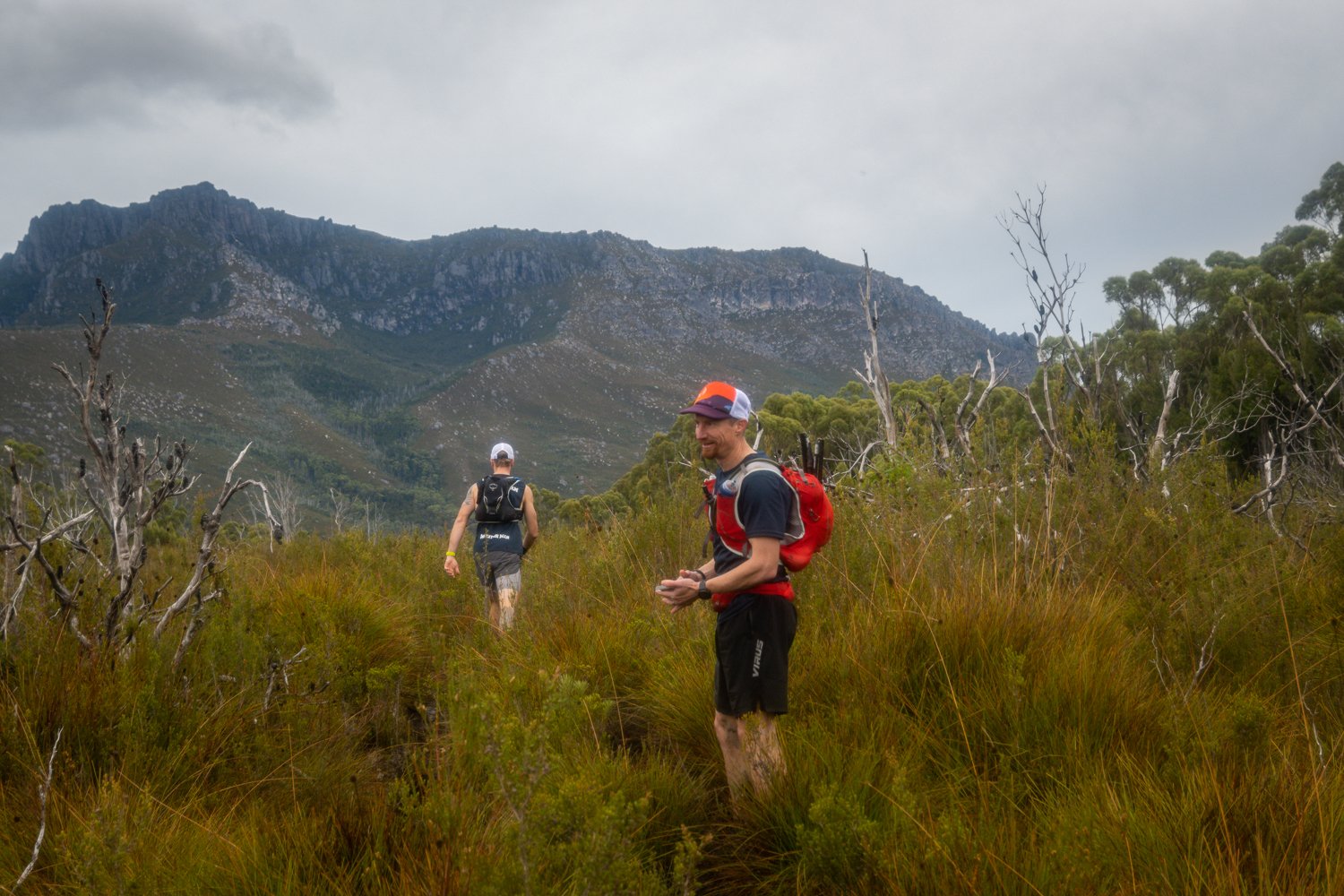
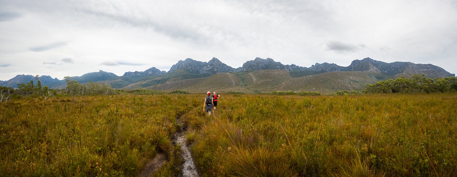
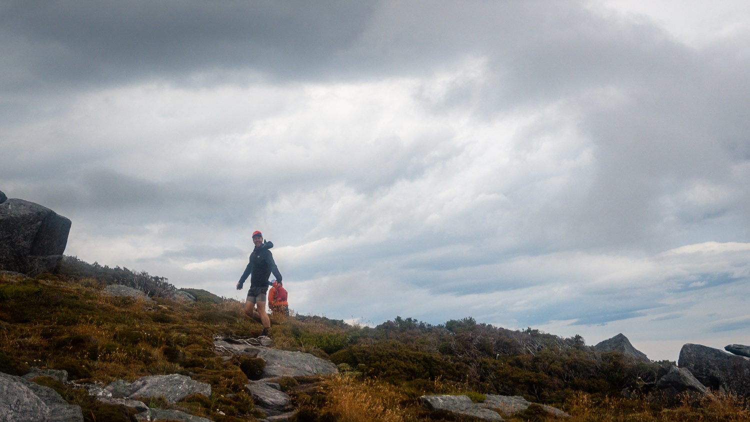
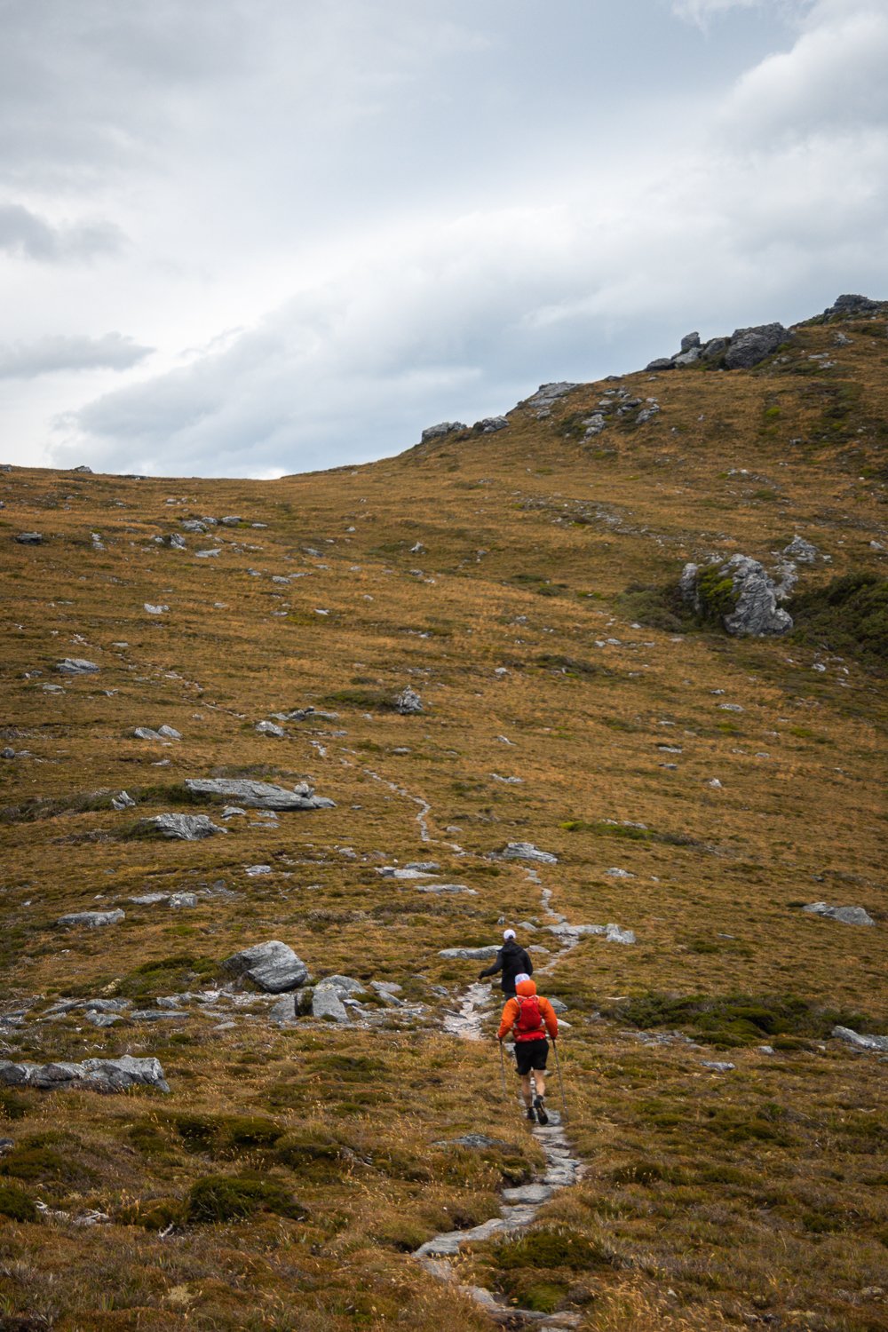
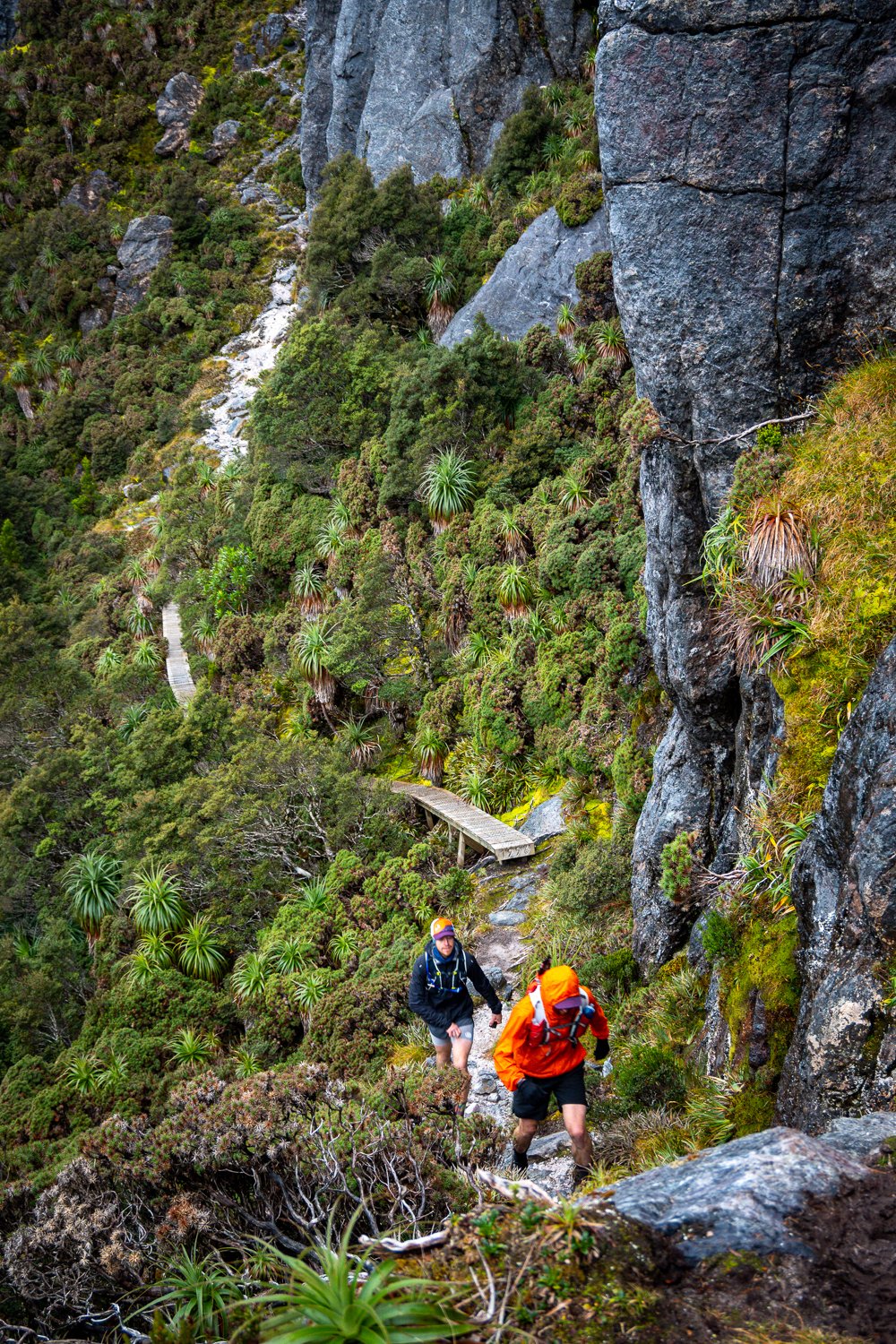
Not long after we started so did the mud. Tasmania’s southwest is renowned for muddy trails and the WA’s were in force, a weeks’ worth of consistent rain really made things wet and slushy. Kind of like running through mac and cheese all day. However, this just added to the entertainment and there was more slipping and sliding than a day at Wet N Wild.
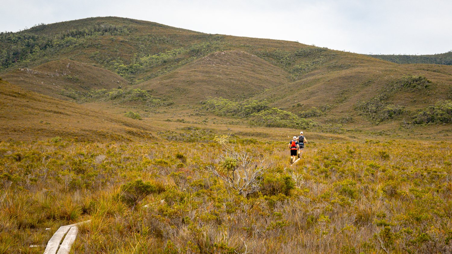
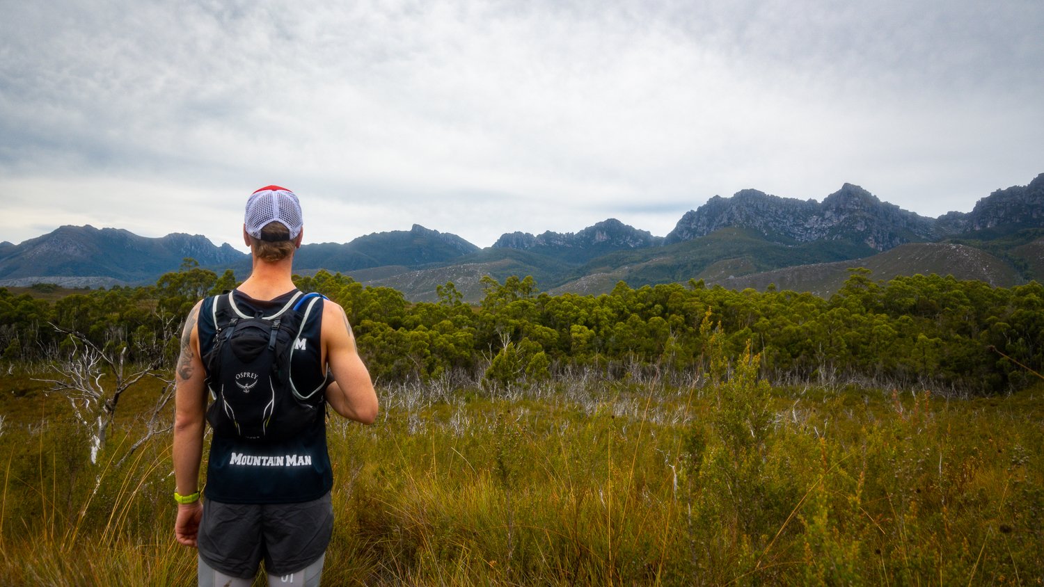
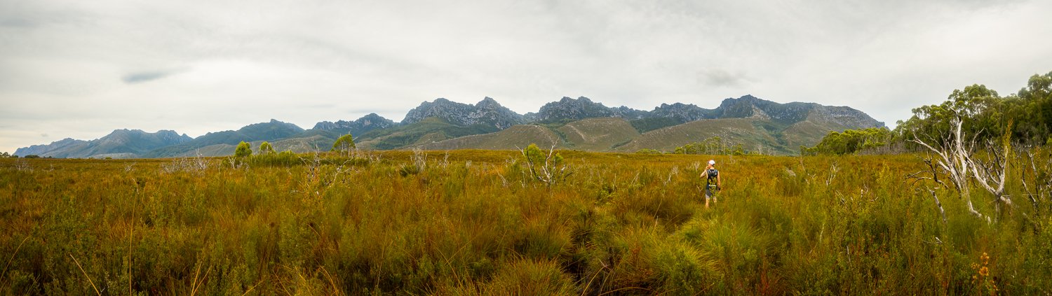
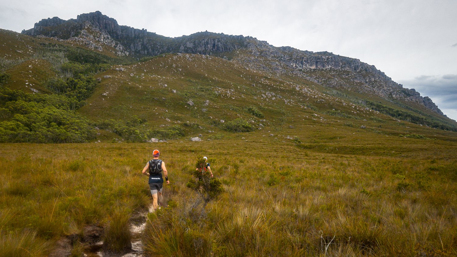
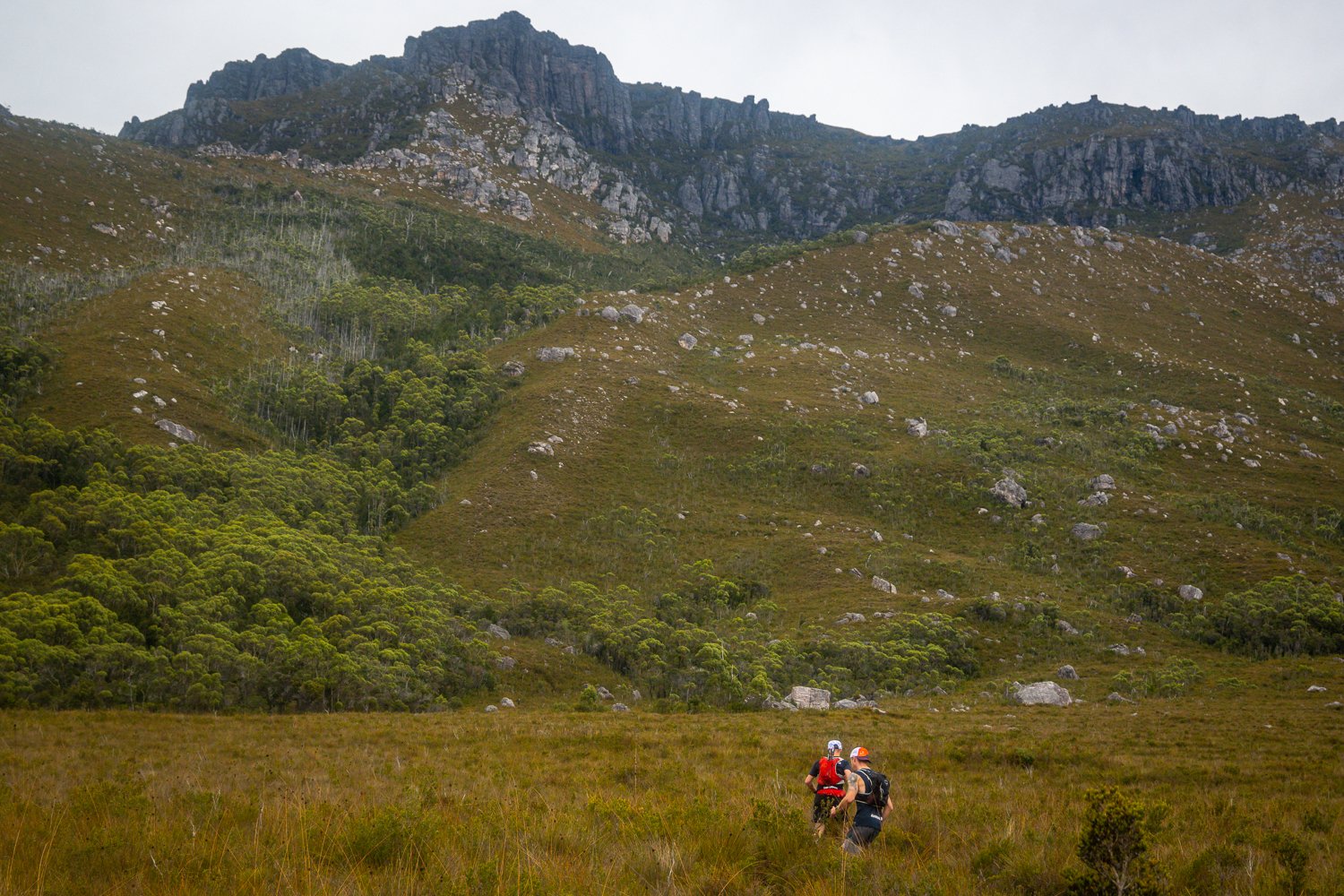
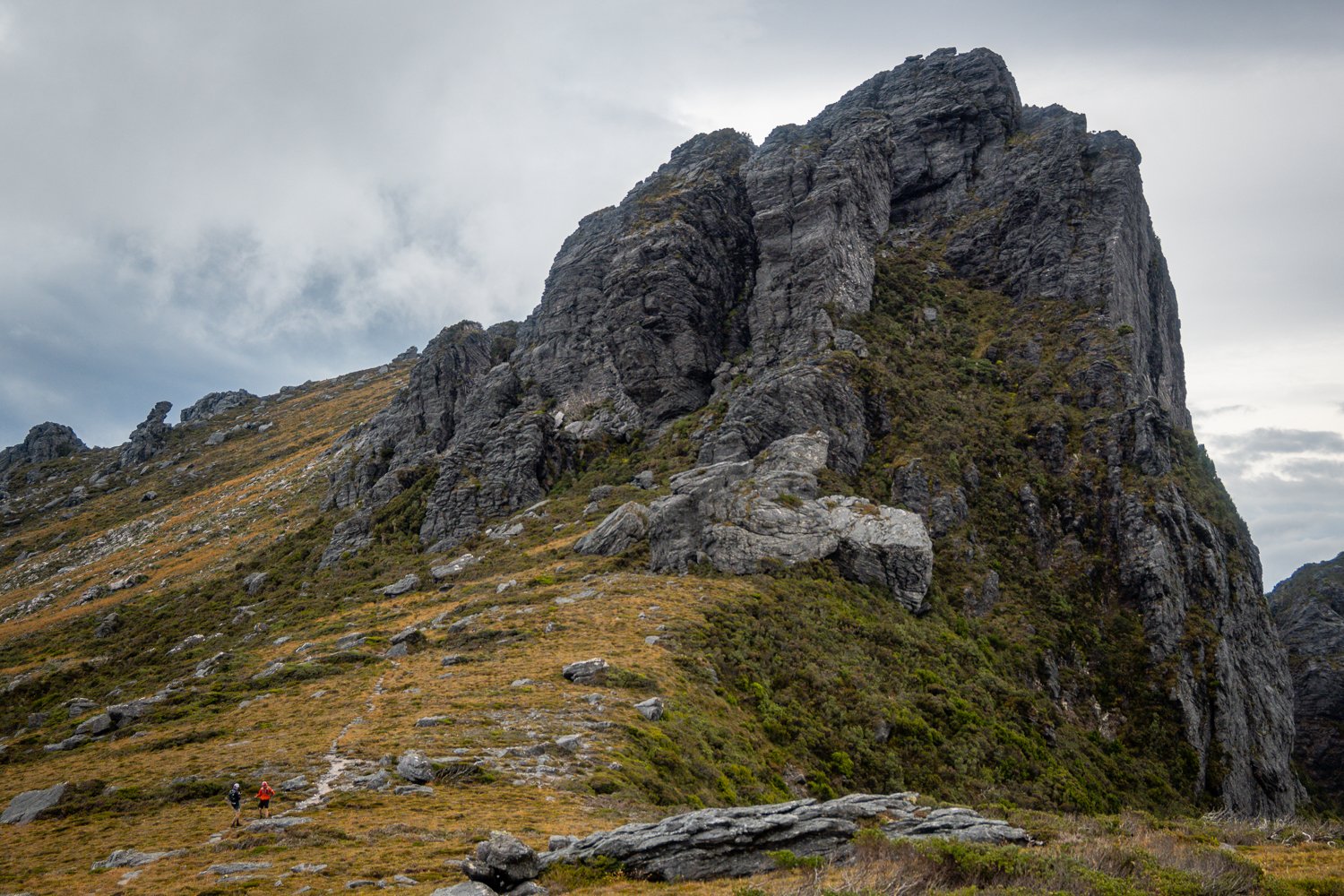
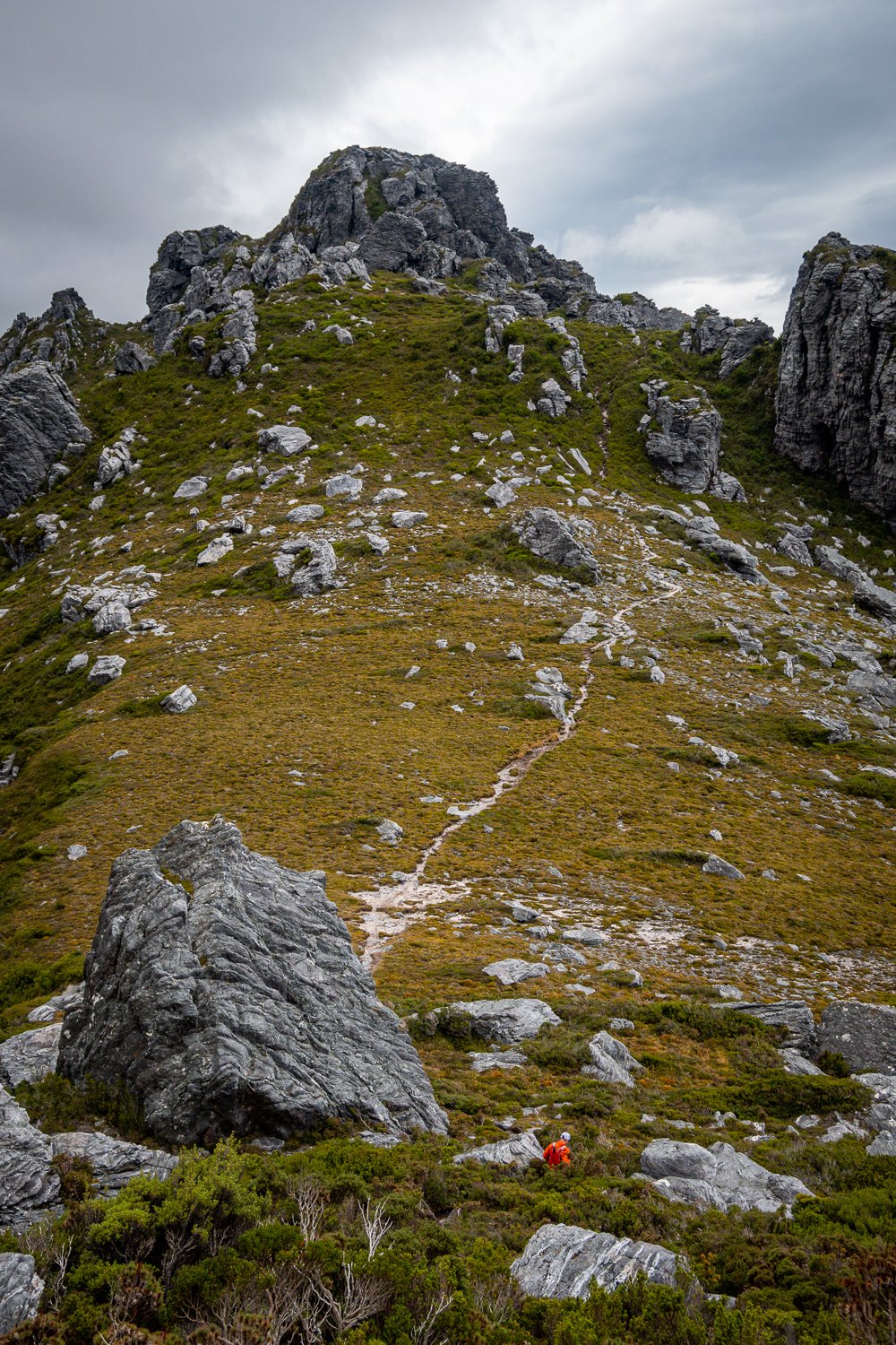
After passing through Junction Creek campground the whole range comes into view and you get an overwhelming sense of the challenge that lies ahead. Knowing what was instore only excited us and the moment Francois pointed at the imposing range ahead of us and cried “Let’s go that way” will be a saying that sticks with our group forever.

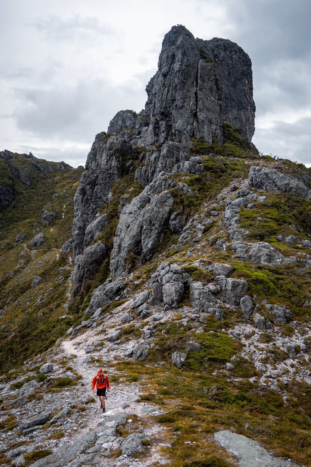
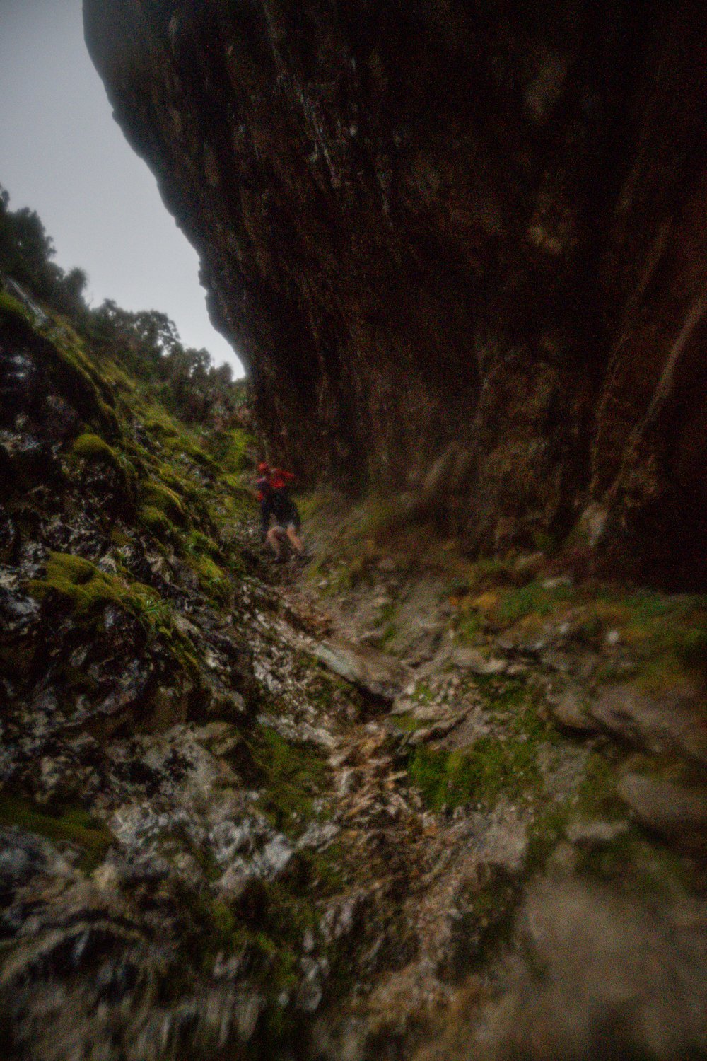
We arrived at the base of Moraine A which is the main access to the range, with 7-800m elevation over 2.4km it’s a juicy little number. I’ve climbed it with a heavy pack three times before and it hurt. In the heat it’s brutal and you easily get dehydrated. In the wet it’s dangerous because you work up a sweat that causes you to be wet and warm.
The problem with wet and warm is, when you hit the range the wind cuts through you like a knife which causes the body temp to plummet and it’s really easy to become hypothermic. I know because it happened to me on my first time up there. If it wasn’t for my friends who guided me to camp, erected my tent and put me to bed I would have been in big trouble.
So, powering up there with 3kg in my pack instead of 30kg was a much more enjoyable experience. The views across Lake Pedder are breathtaking, just like the strong slap in the face from the southerly winds coming straight off the Southern Ocean when you arrive.
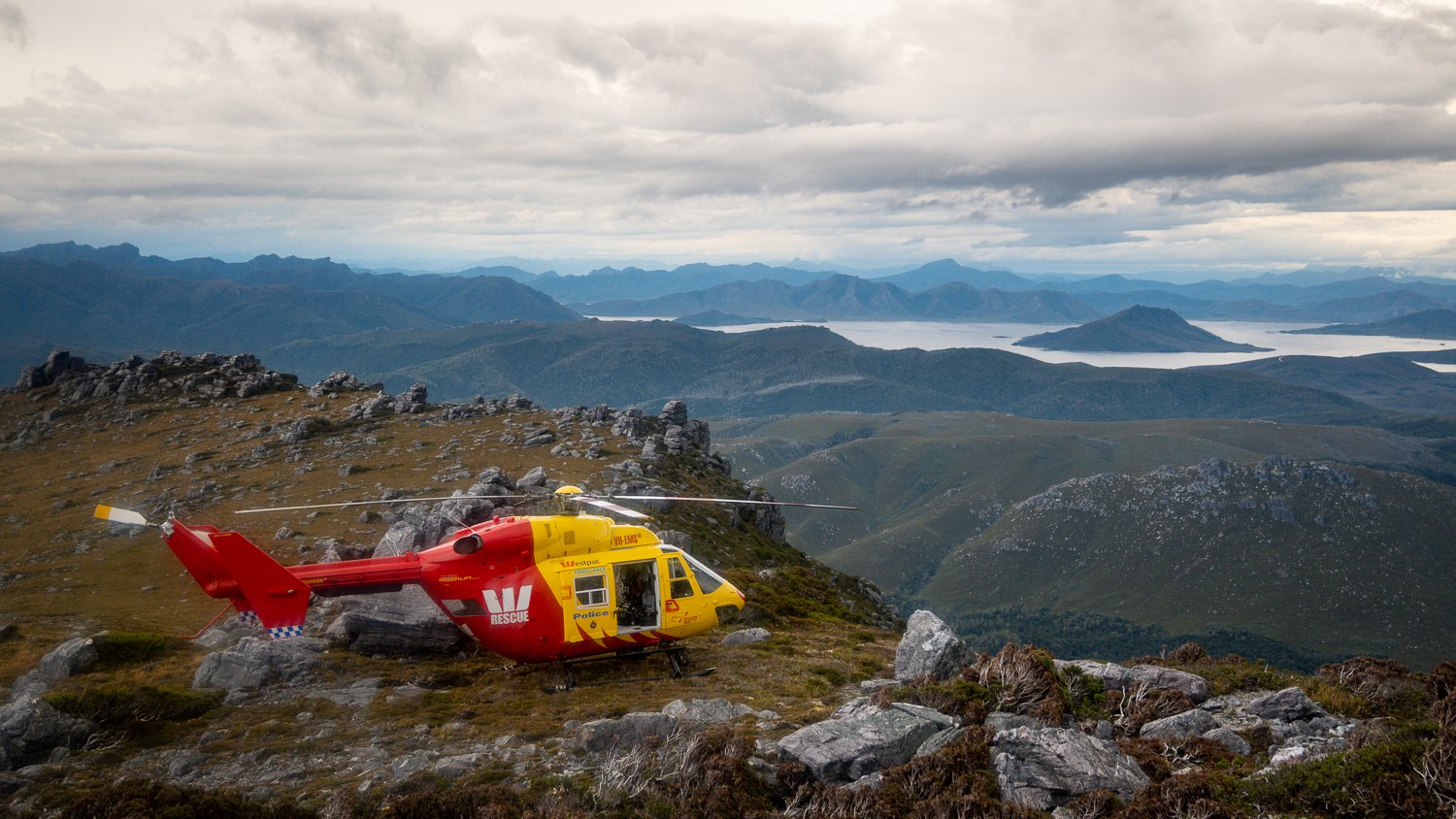
As we started along the range a Westpac Rescue Helicopter flew in and landed close by. It shocked us to begin with and we wondered if our EPIRB had accidentally been triggered but apparently they rescued someone with a broken wrist. I don’t have any more details but seeing them was a sobering experience and a reminder how quickly things can go wrong.
Always carry an EPIRB people.

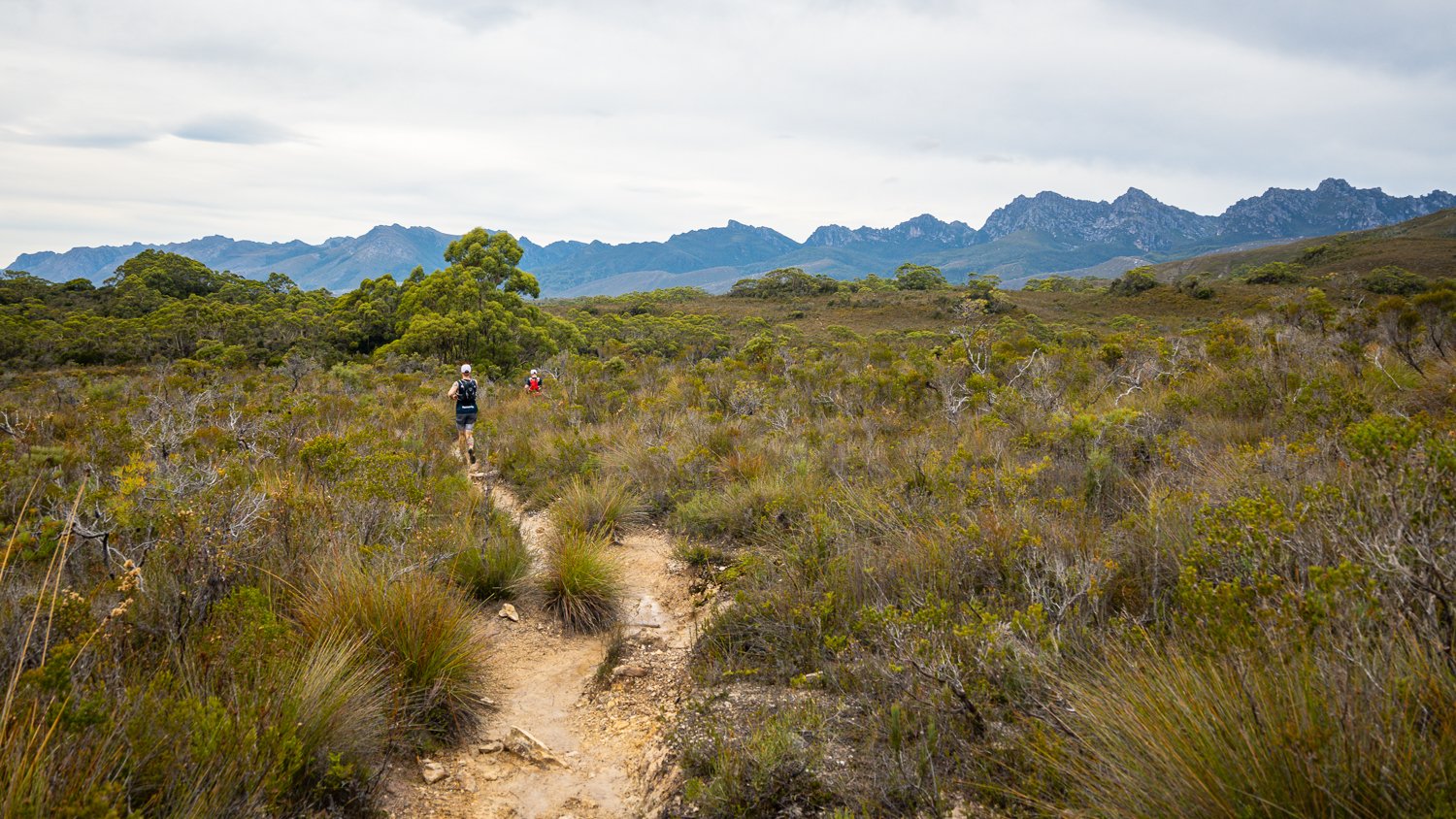
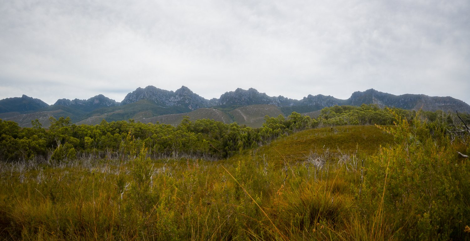
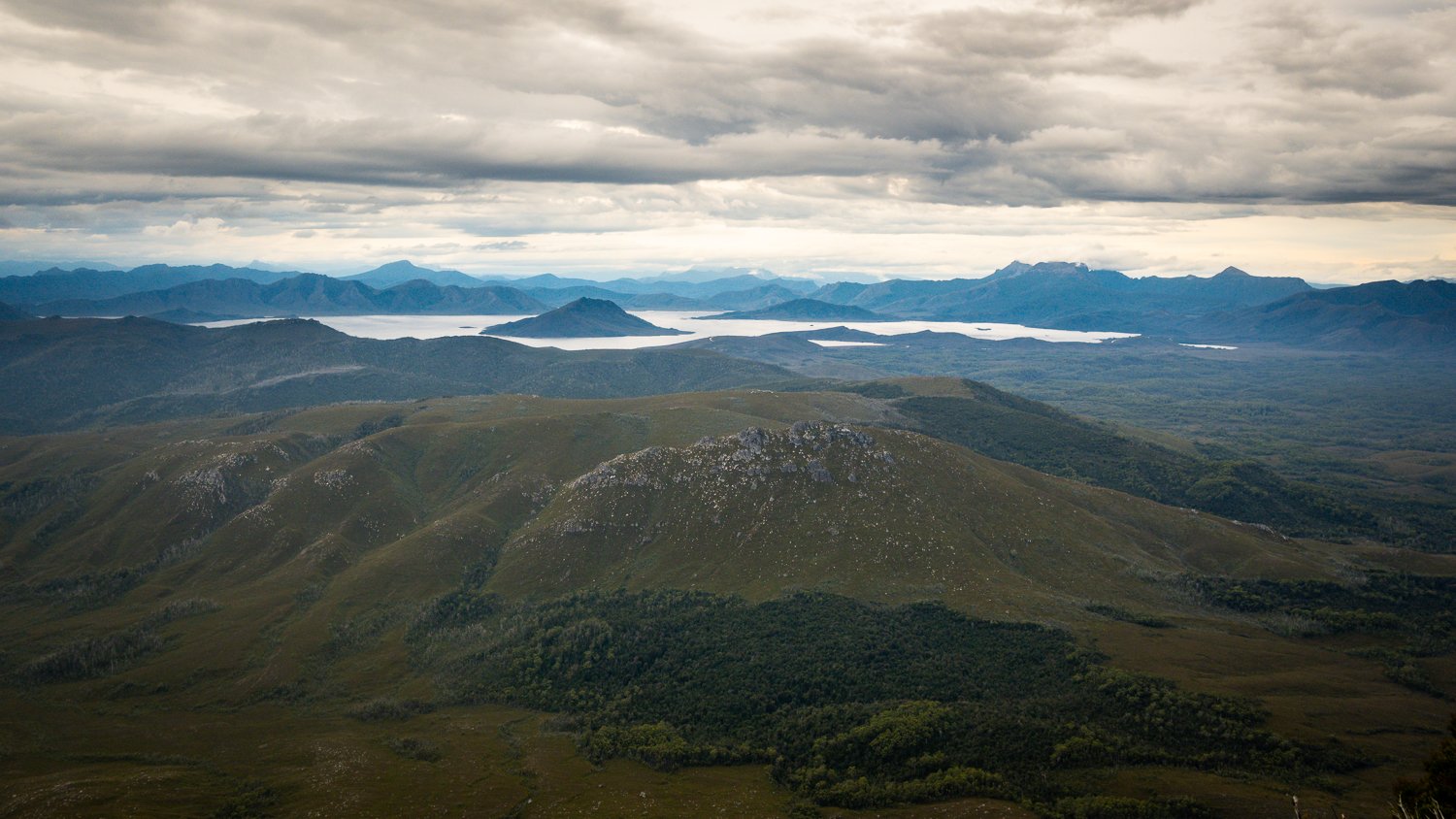
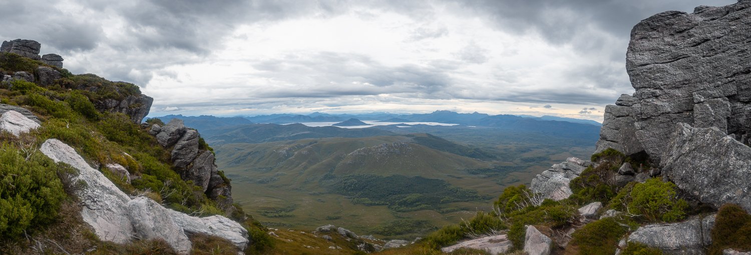
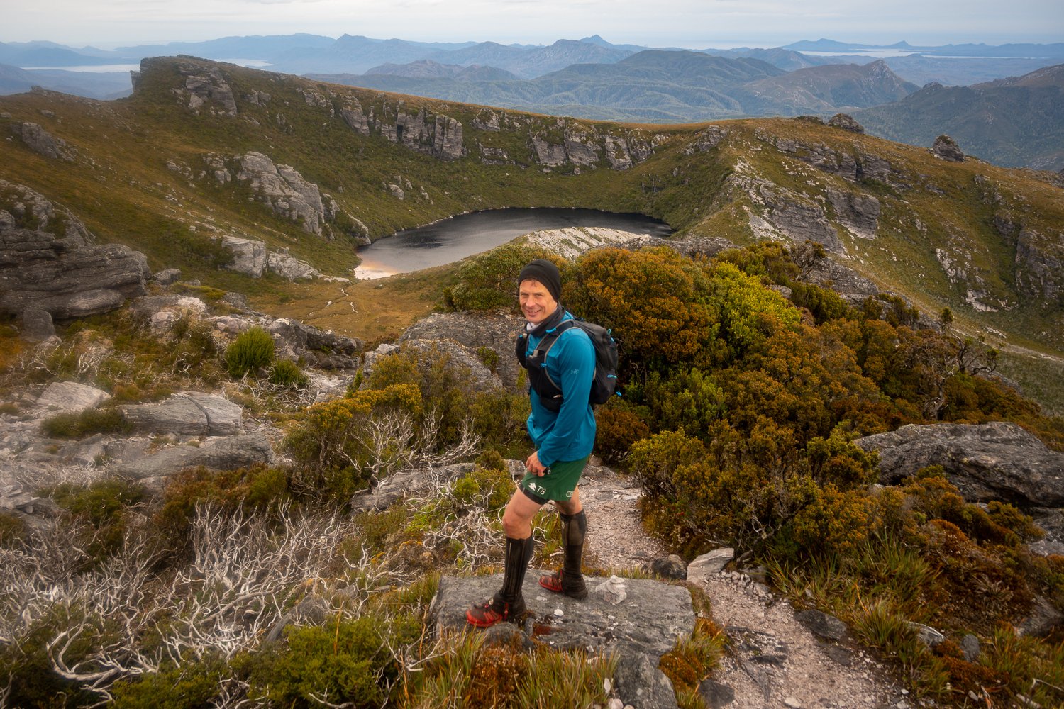
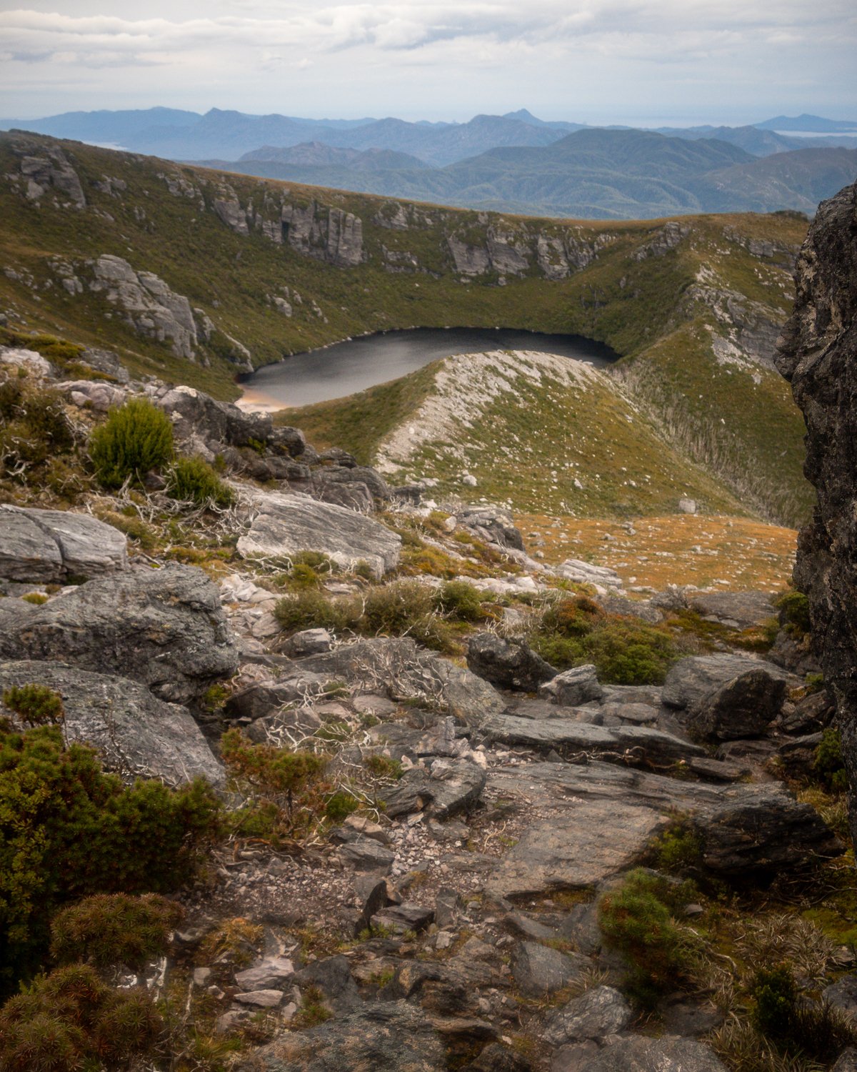
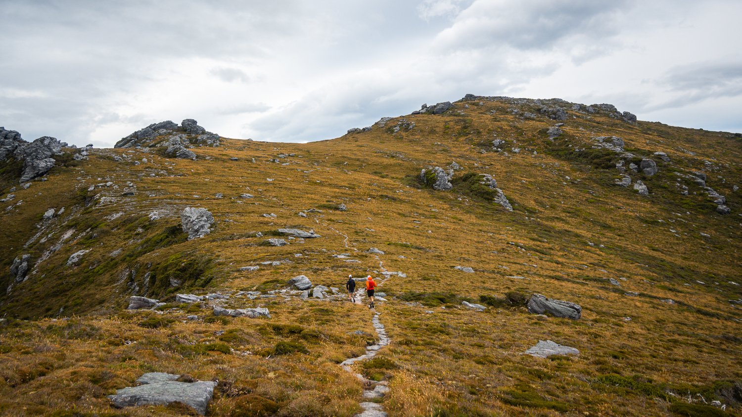
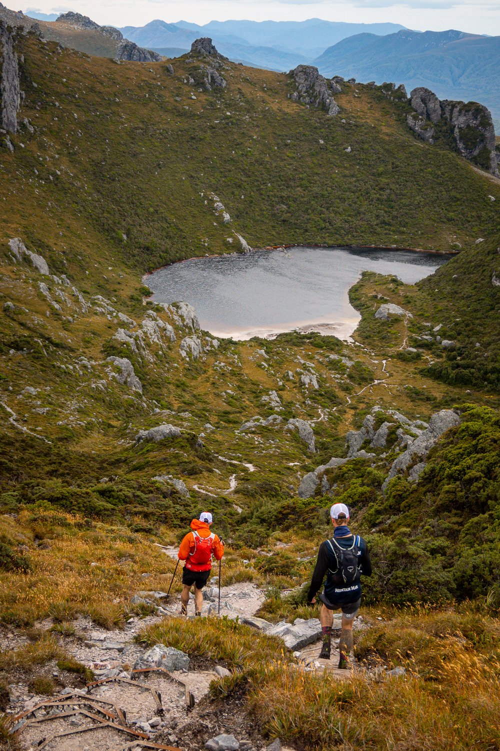
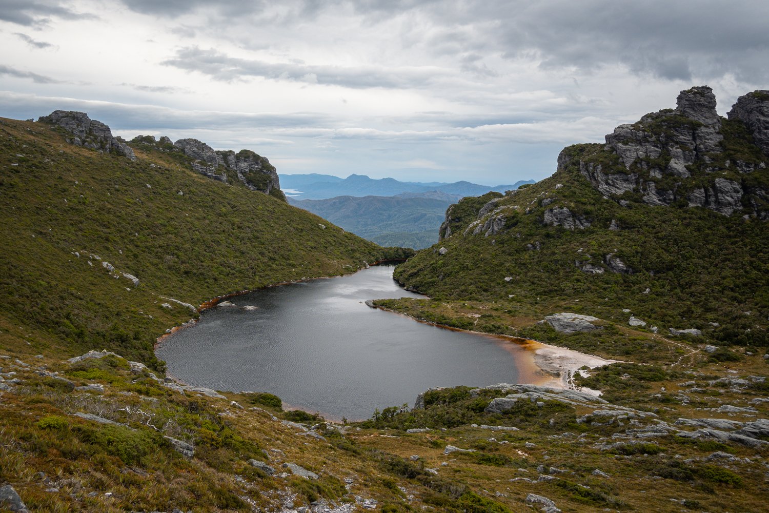
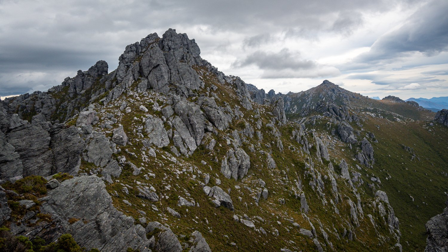
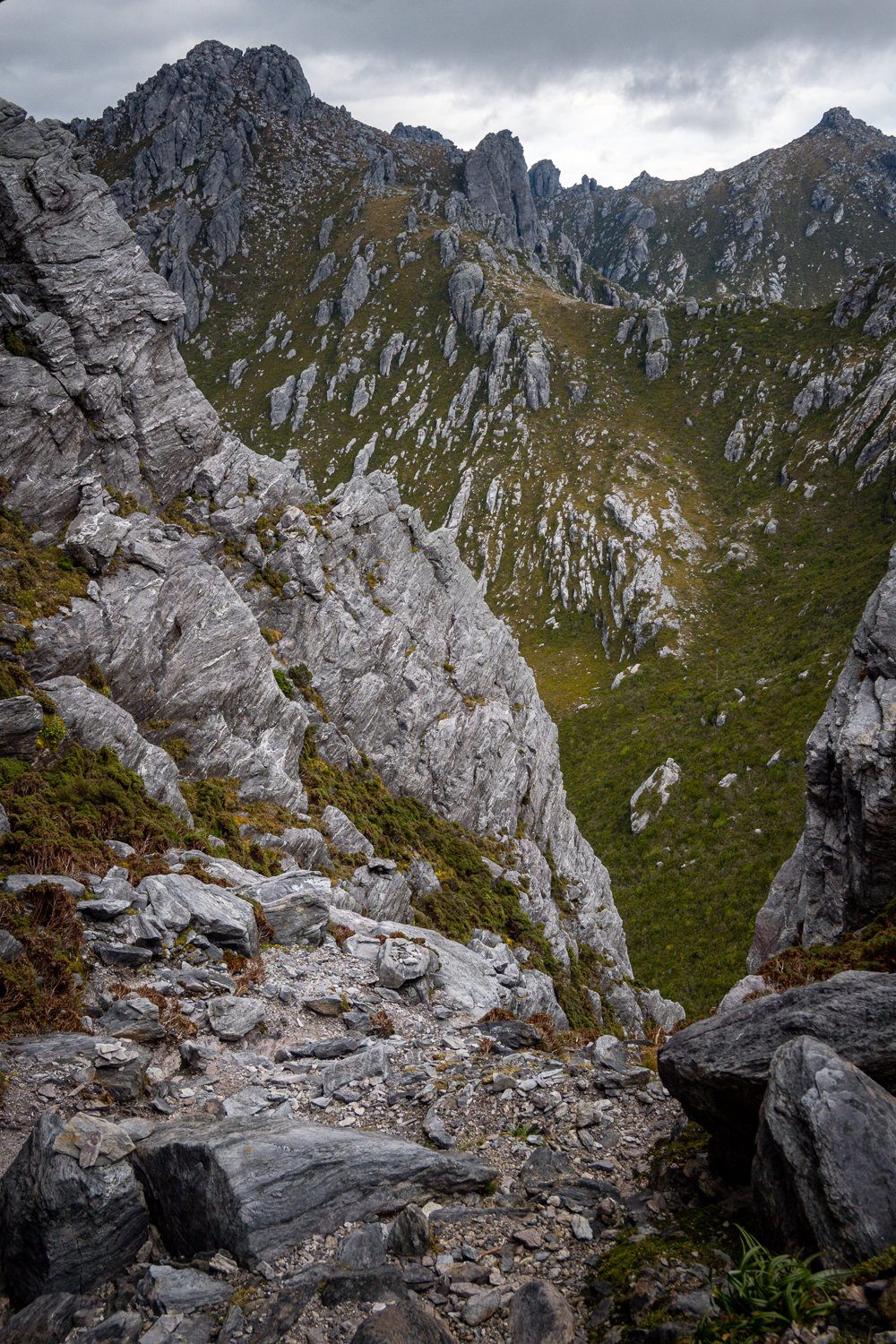
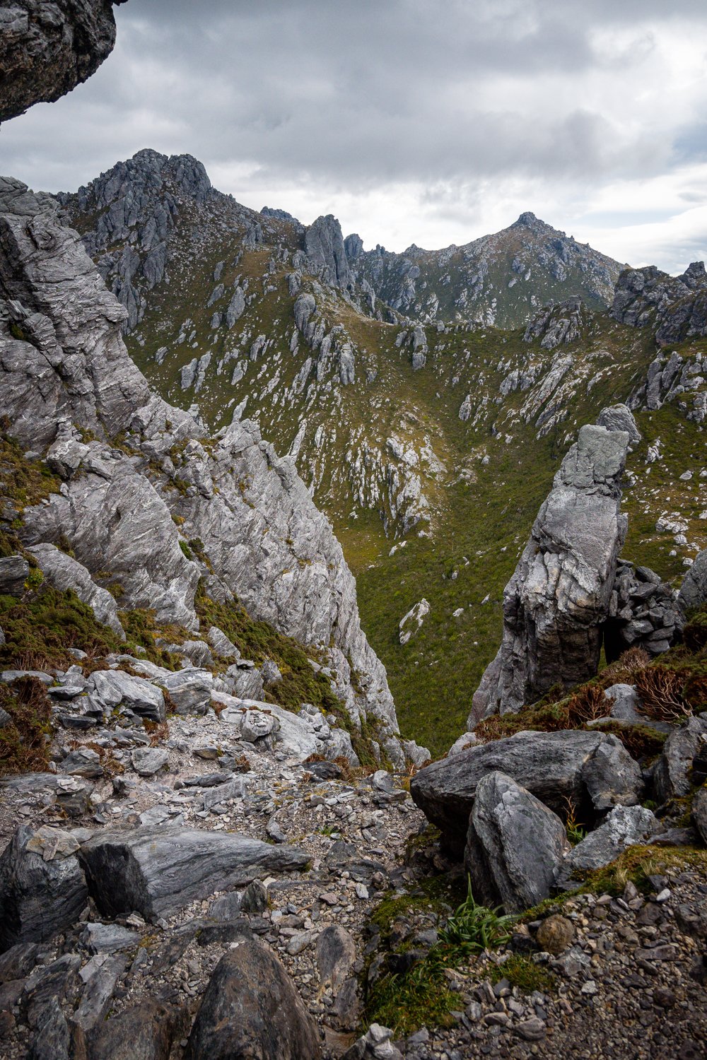
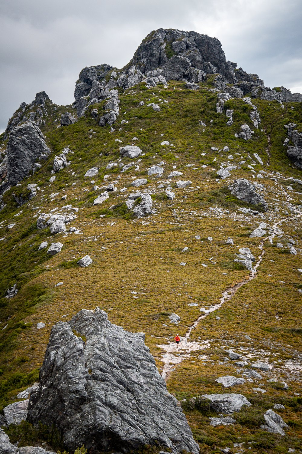
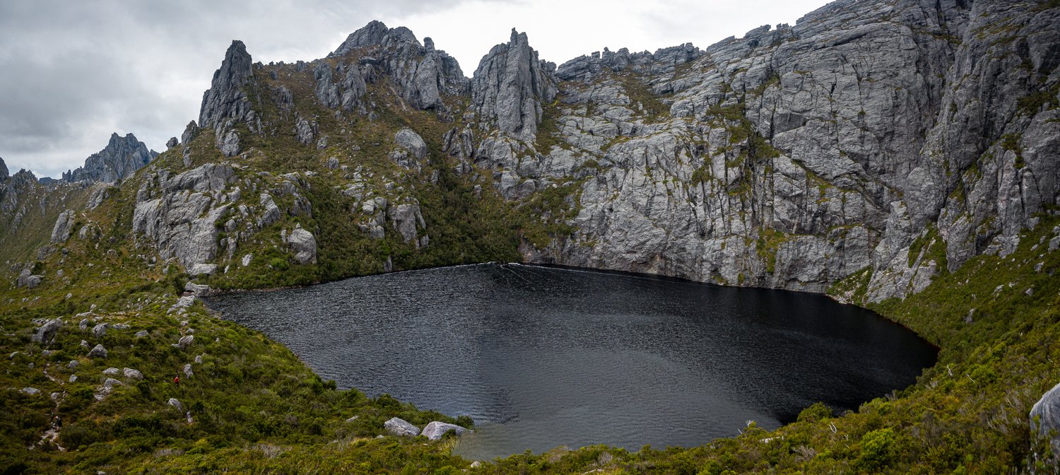
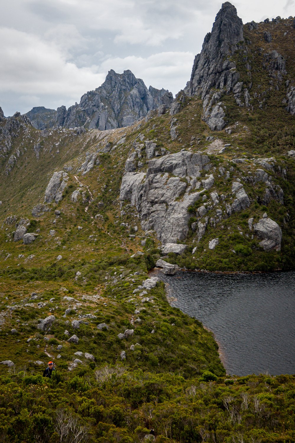
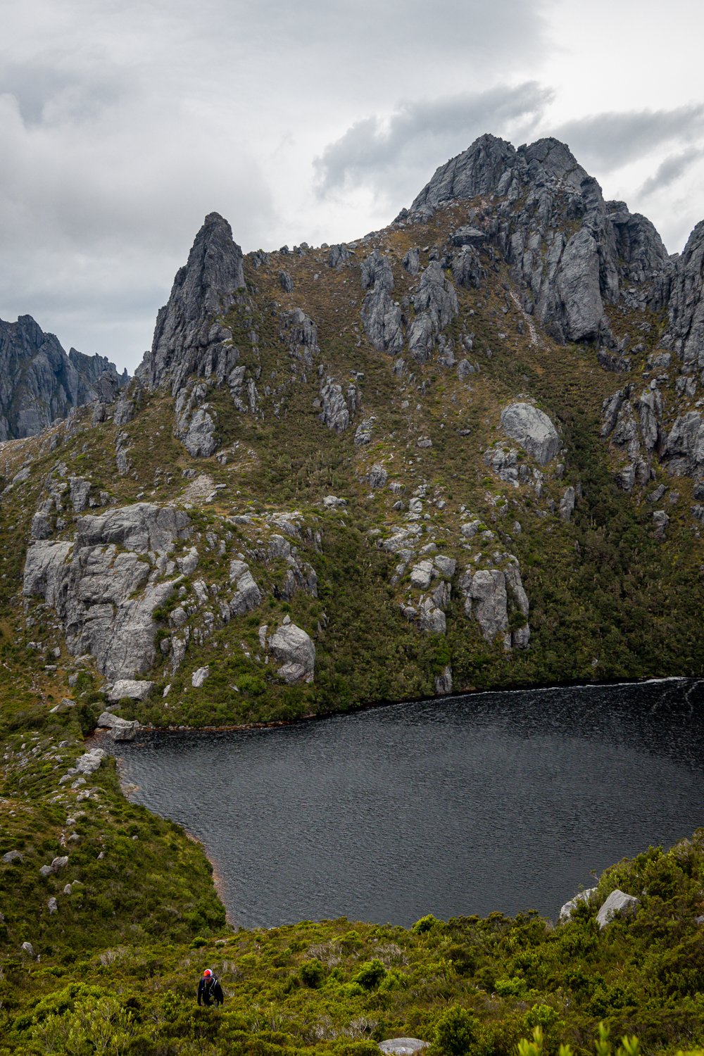
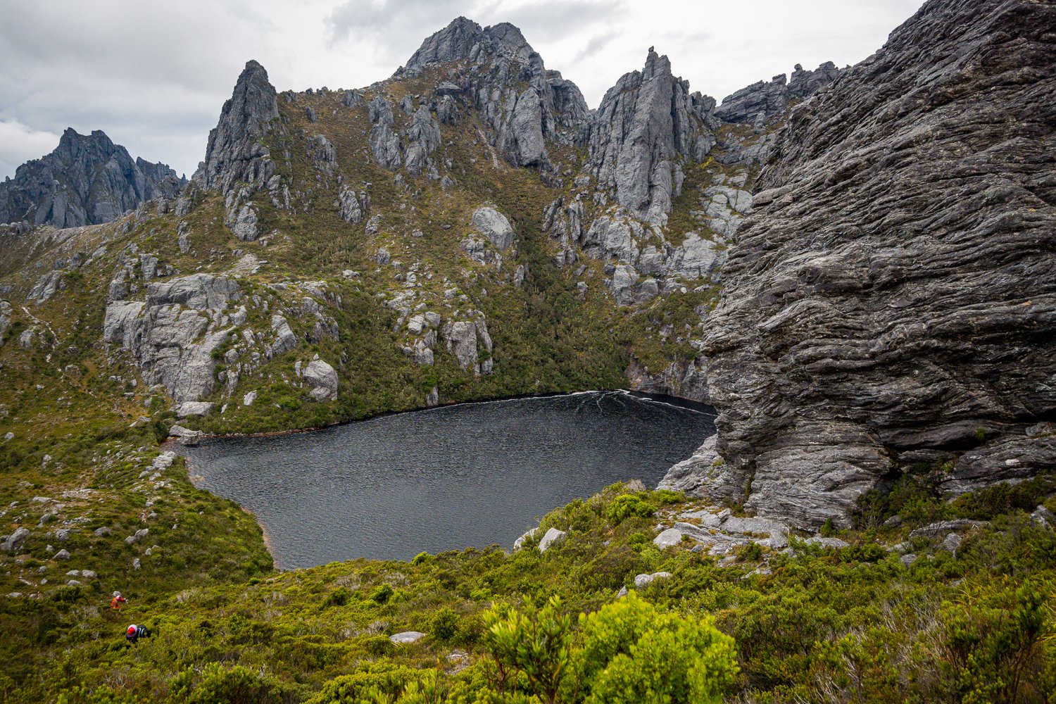
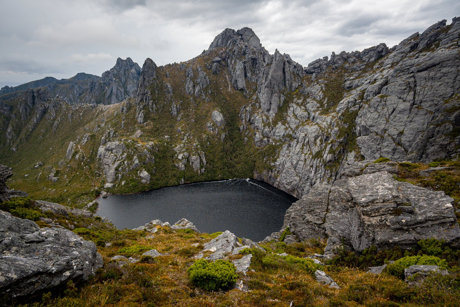
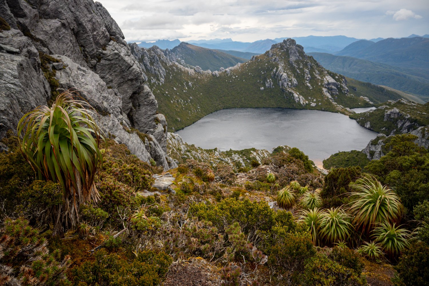
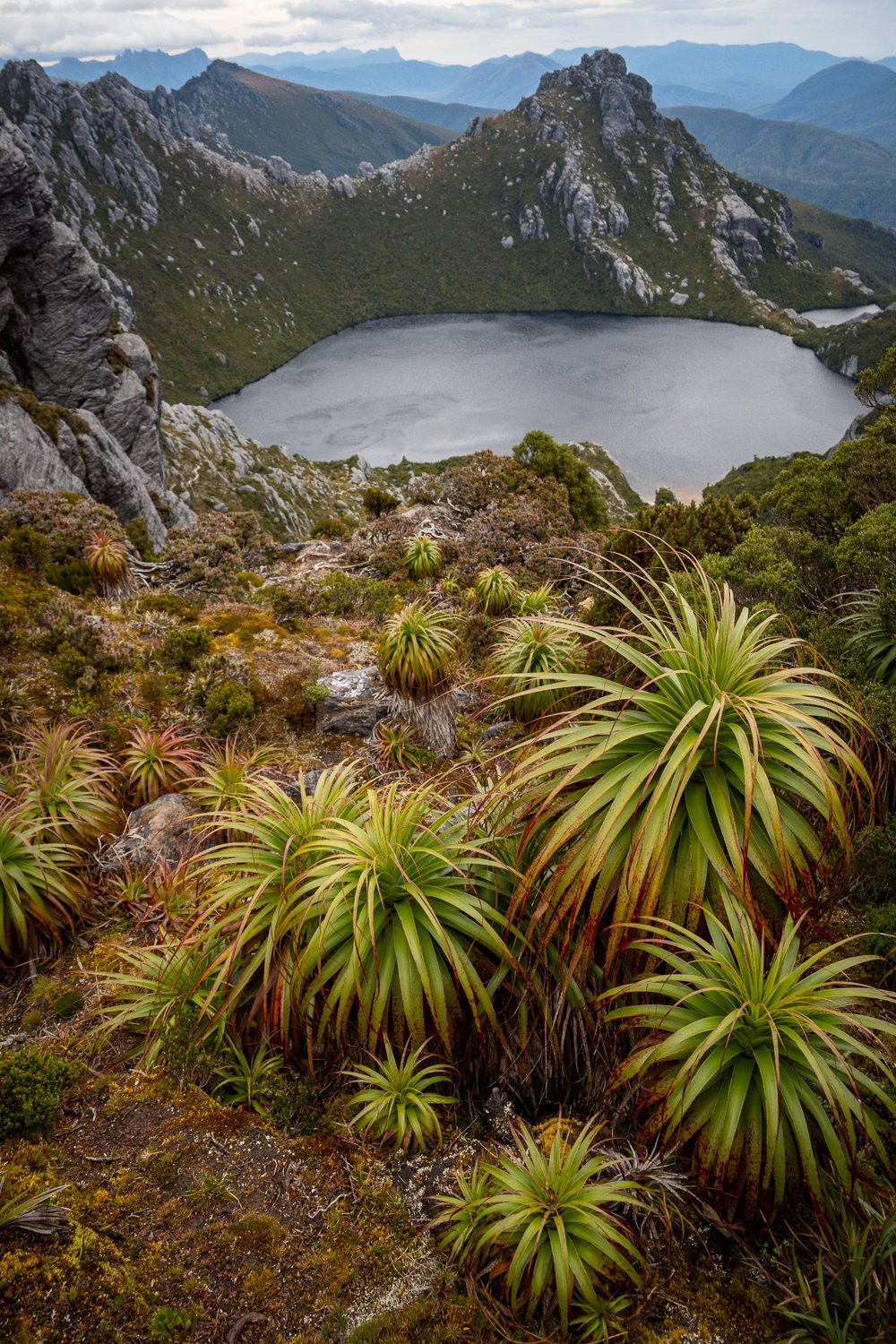
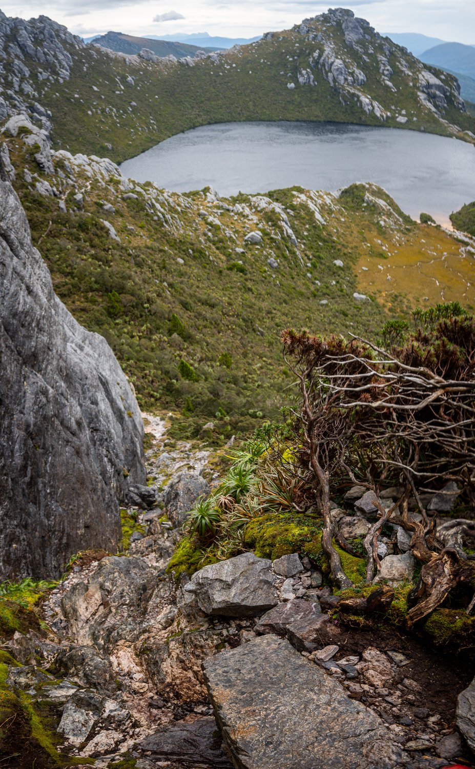
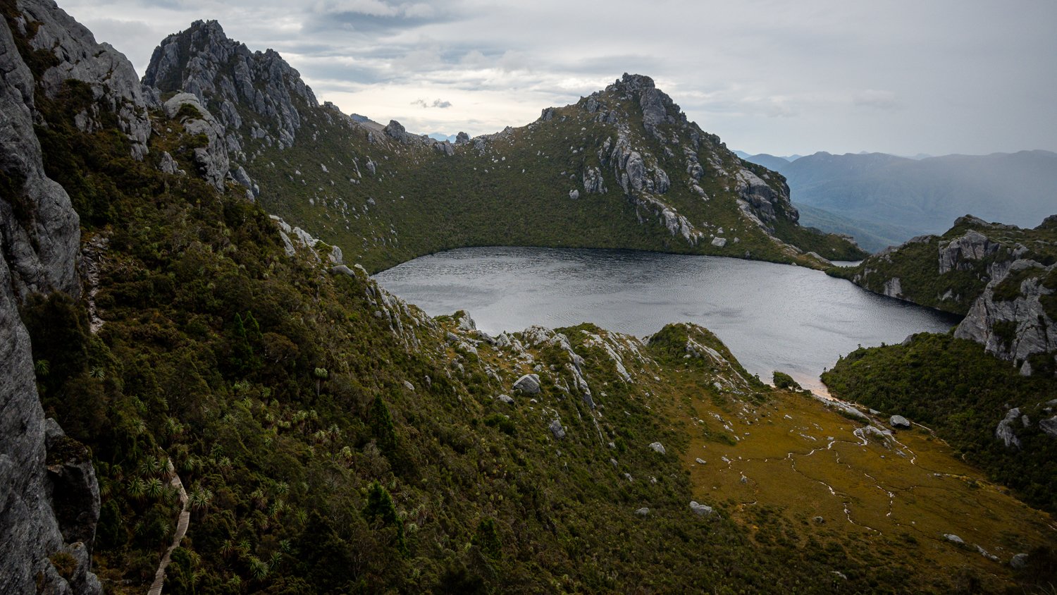
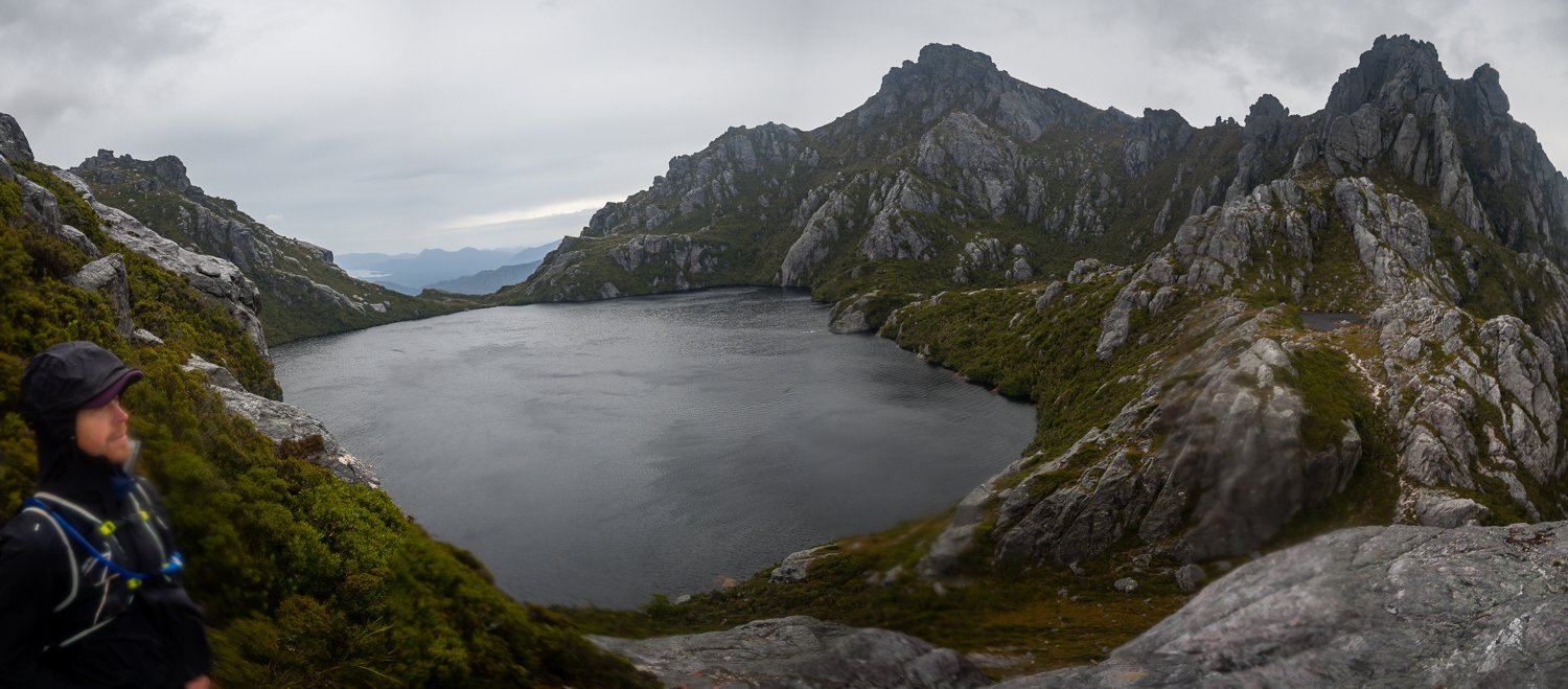
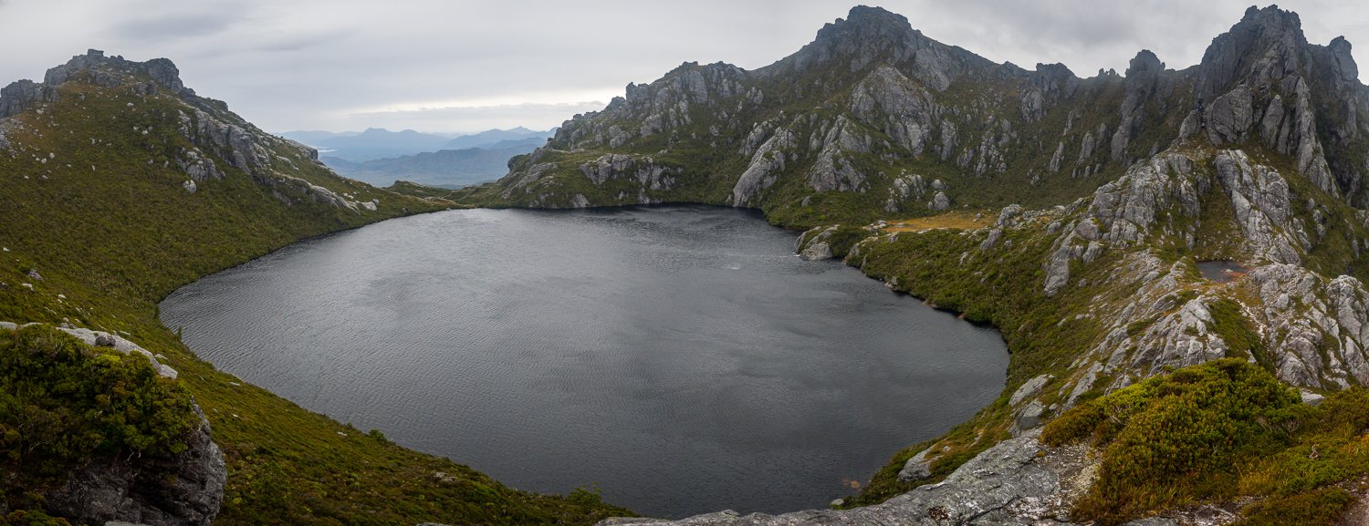
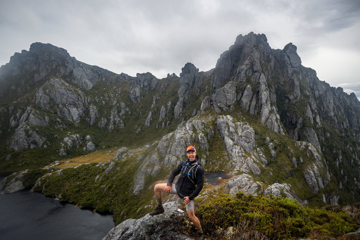
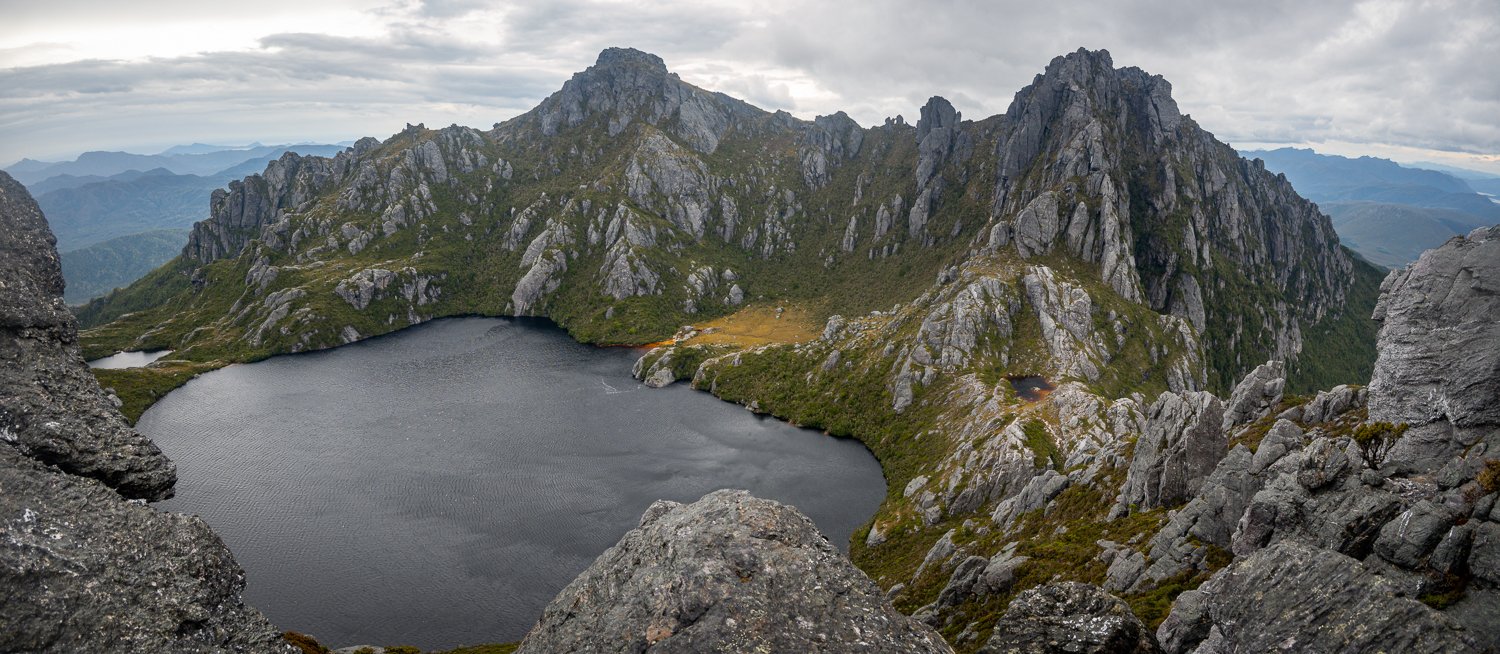
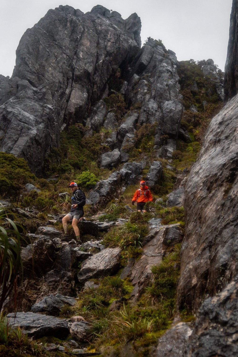
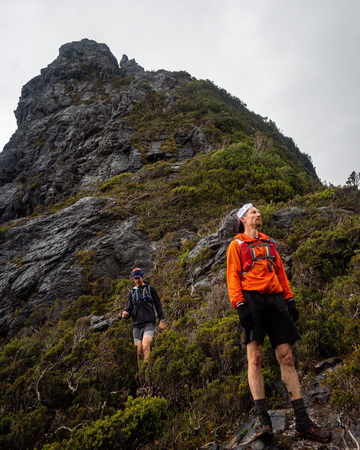
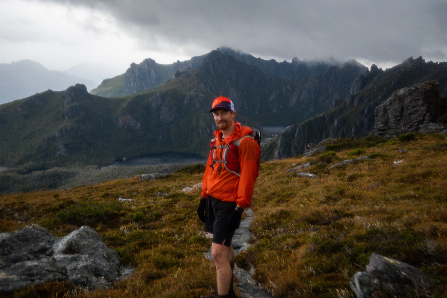
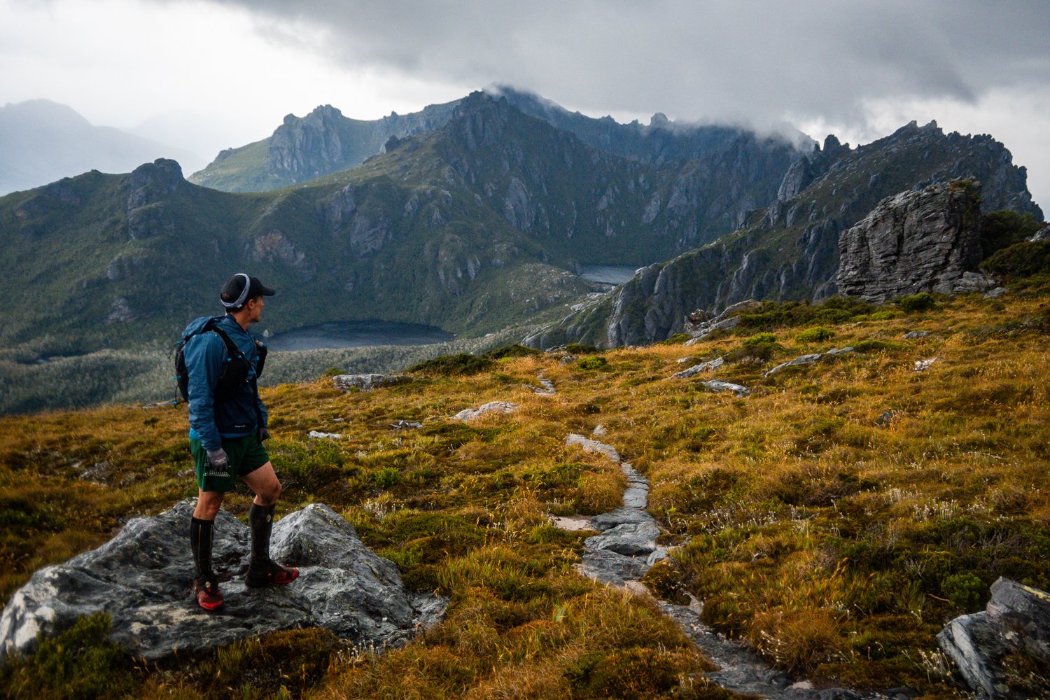
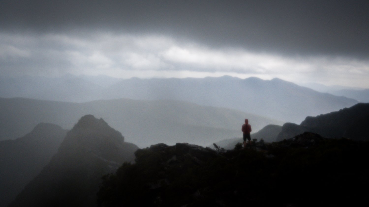
The jog past Lake Fortuna through to Lake Cygnus is beautiful, you have officially arrived on the range and the landscape changes dramatically. Everything is massive and looks like a scene out of The Lord of the Rings. Glacier lakes, humongous slabs of quartz and views out to Bathurst Harbour are on the menu for the rest of the day. t’s a real feast for the senses. The pictures do not do it justice and we were all very happy to be back in this very special place.

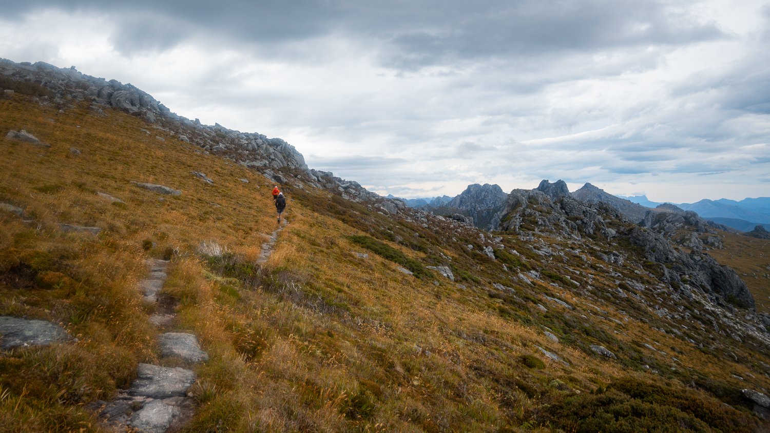
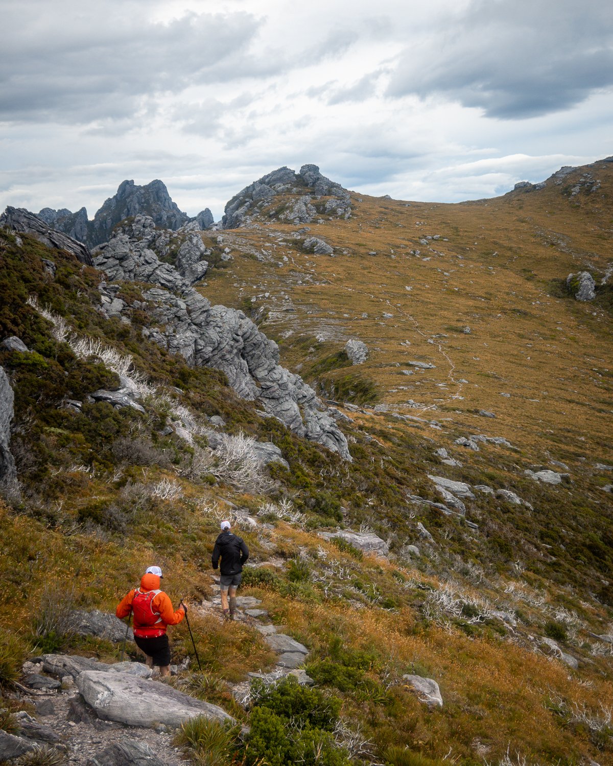
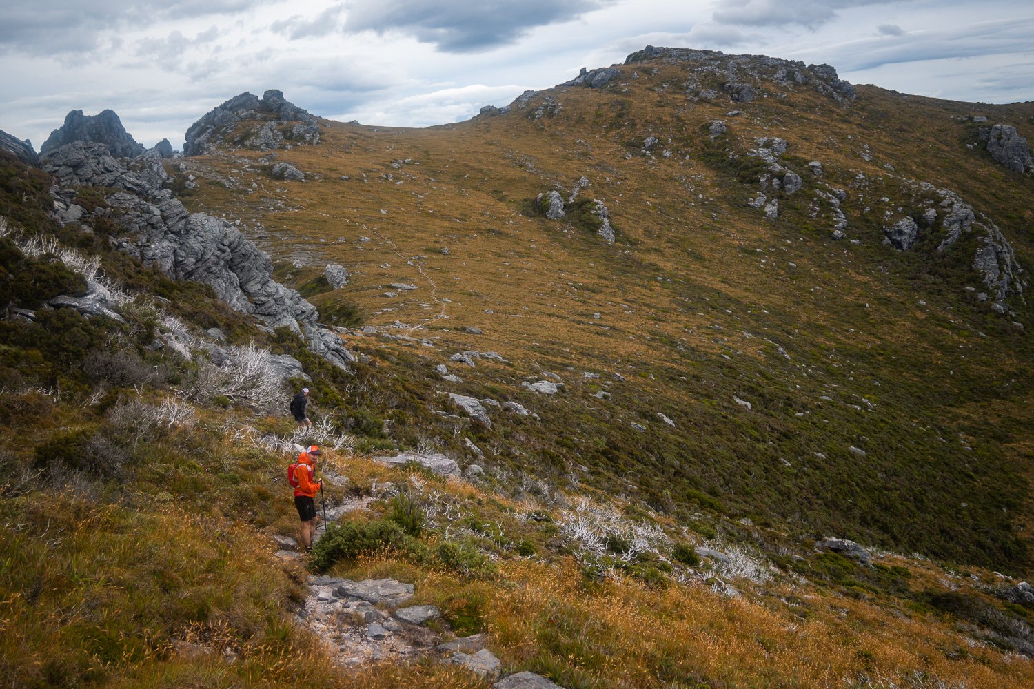
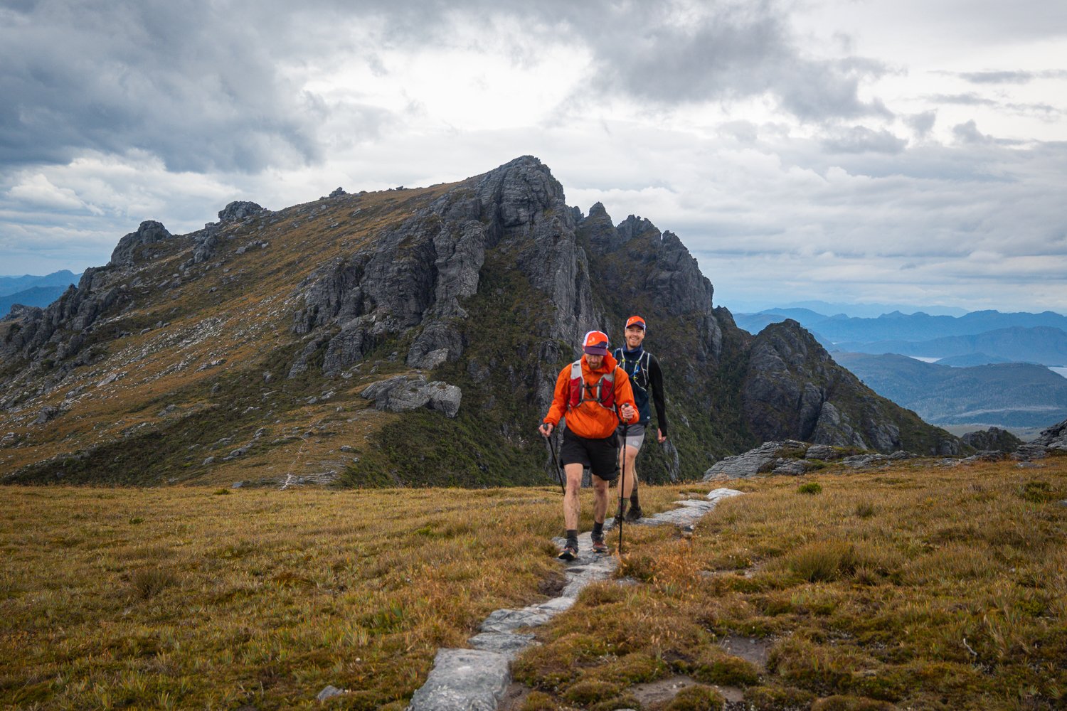
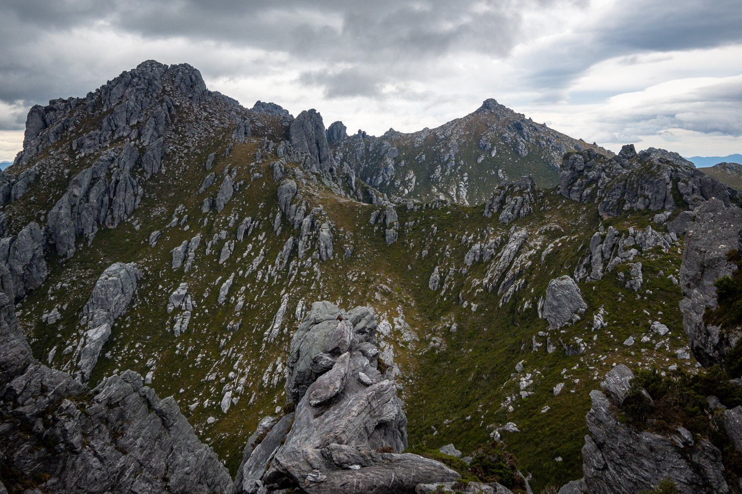
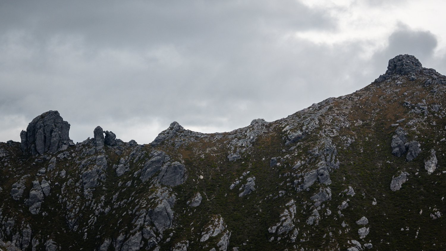
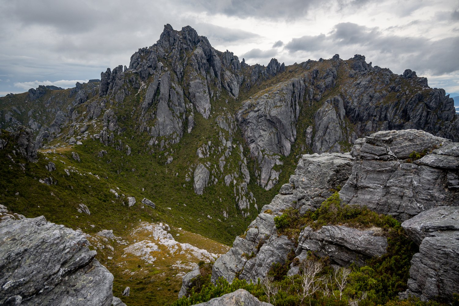
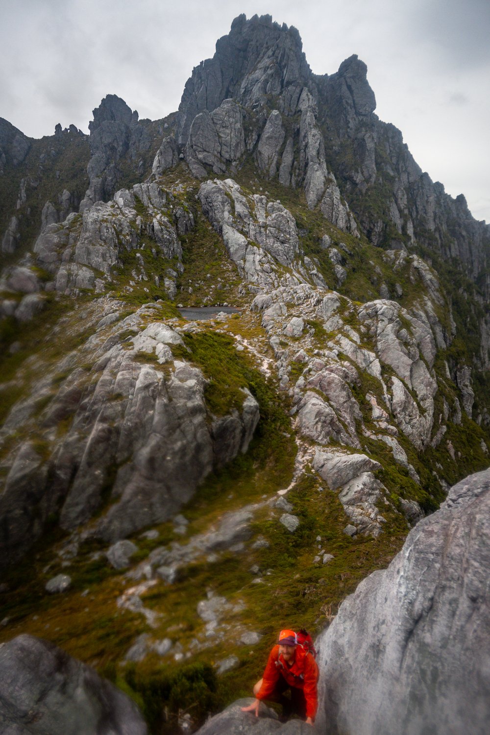
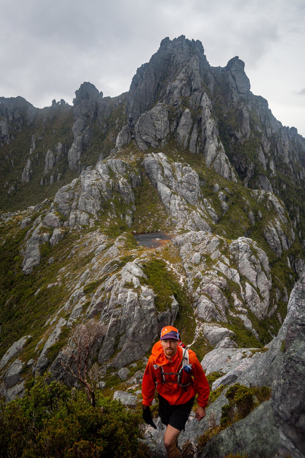
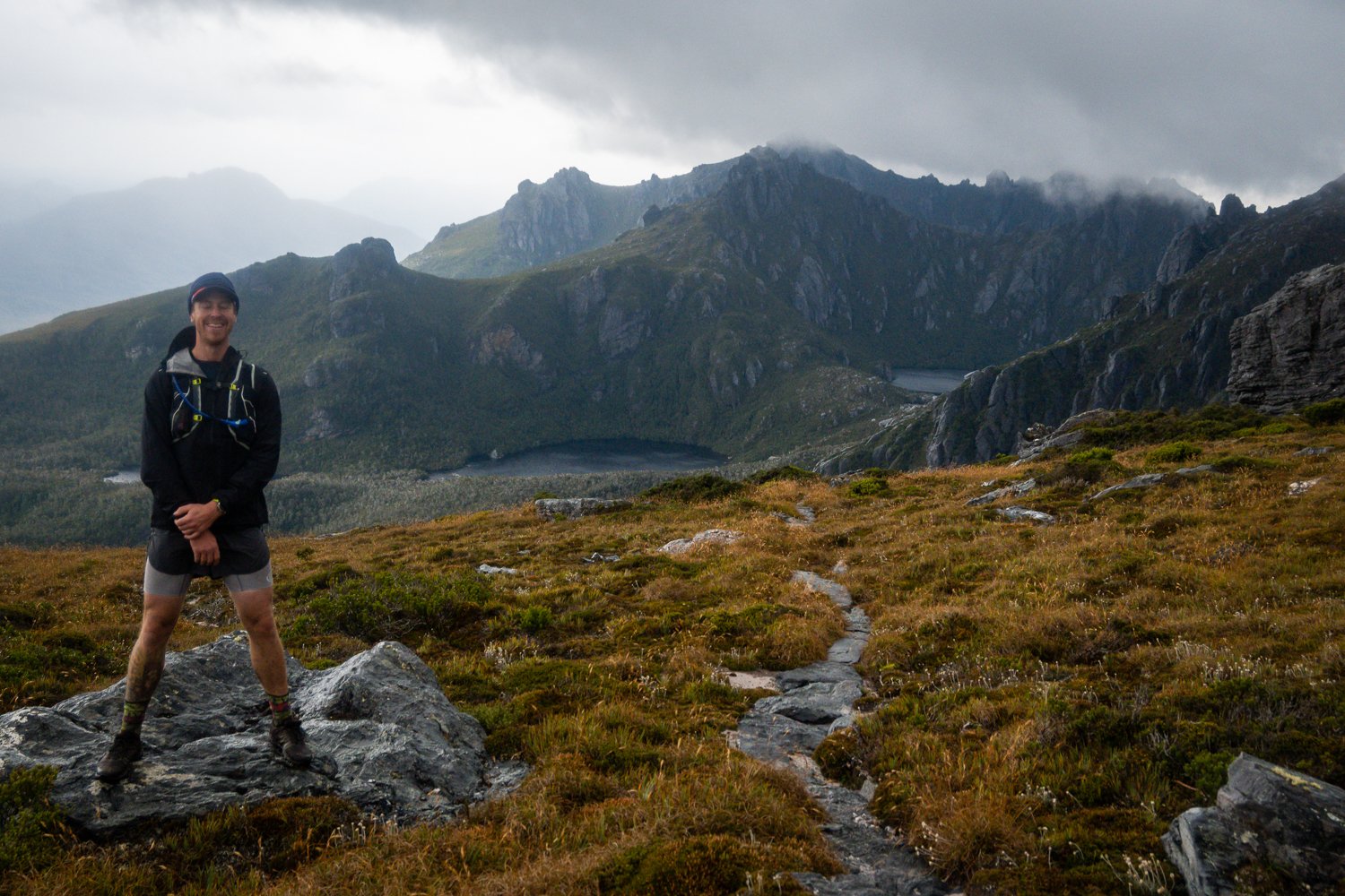
After the Lake Cygnus water stop you do a little more up and downing before the section between Mt Sirius and Mt Orion comes into view. This is one of my favourite ridgelines in Tasmania. It sticks out like crazy and can be seen for miles. So many times you look back thinking, holy shit that’s where we have come from!
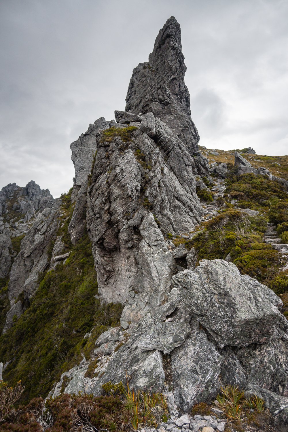
It’s all just so gnarly and the formations are spectacular. If you have a chance to stay close by and do the day walks to each of the peaks, the views and flora are something else.

We arrived at Square Lake and took a moment to fill our water bottle. After I serenaded the range with a heartfelt rendition of my favourite song ‘When Something Is Wrong With My Baby’ we moved on with the dulcet tones of my angelic voice ringing in our ears.
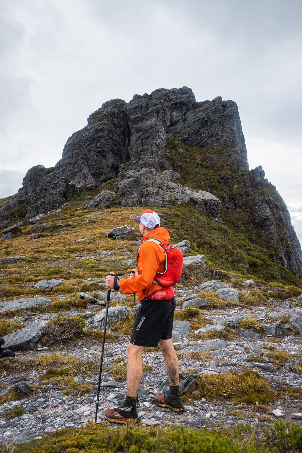
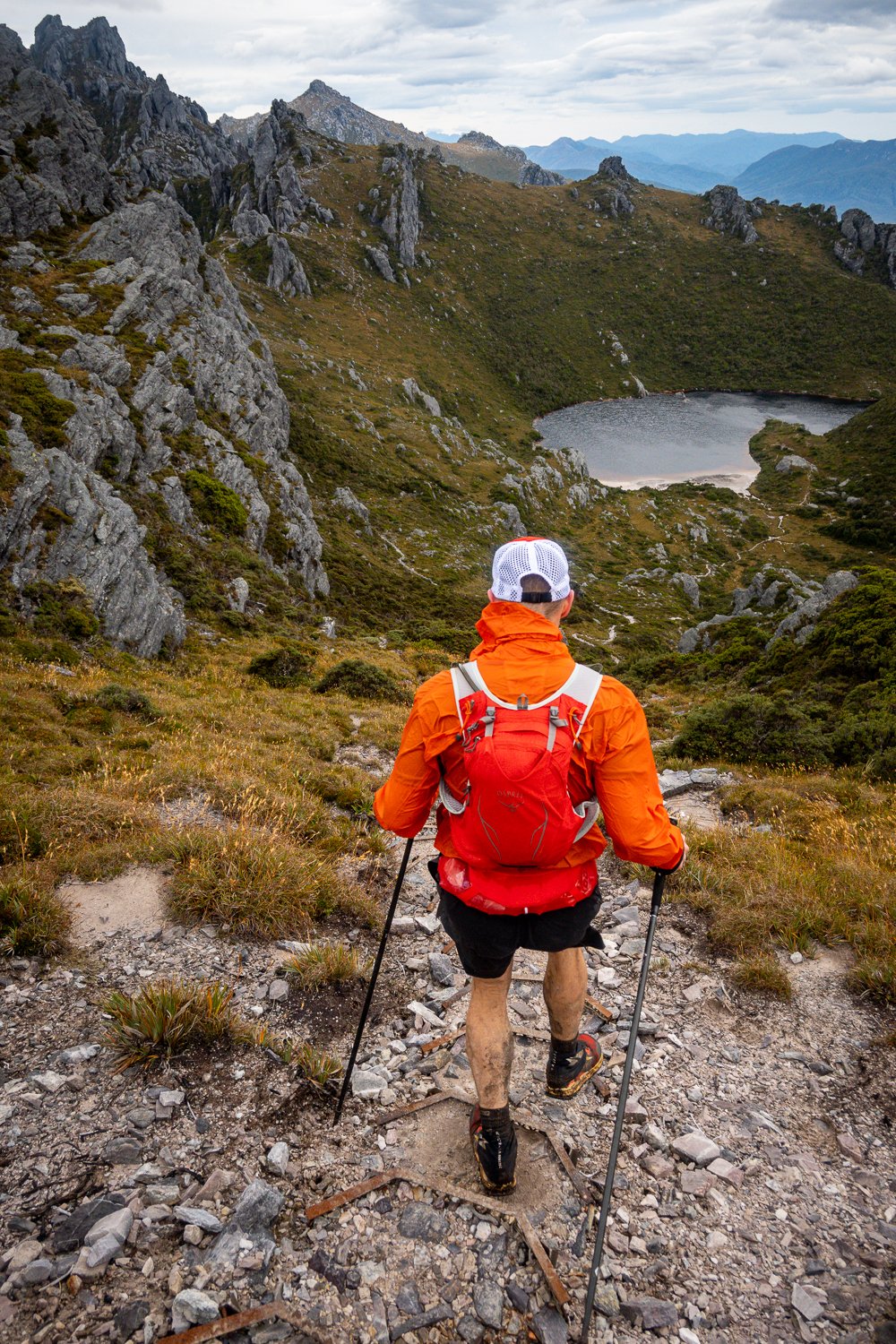
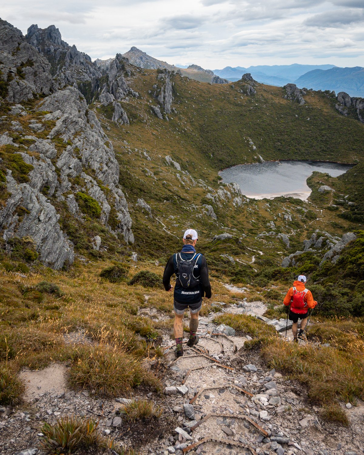
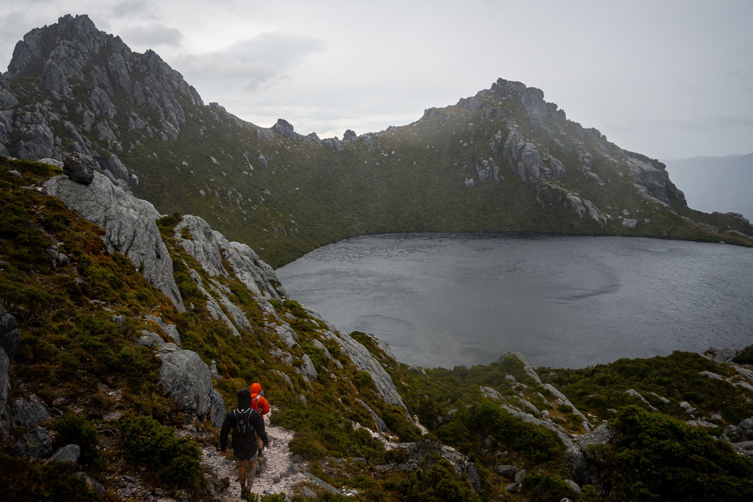
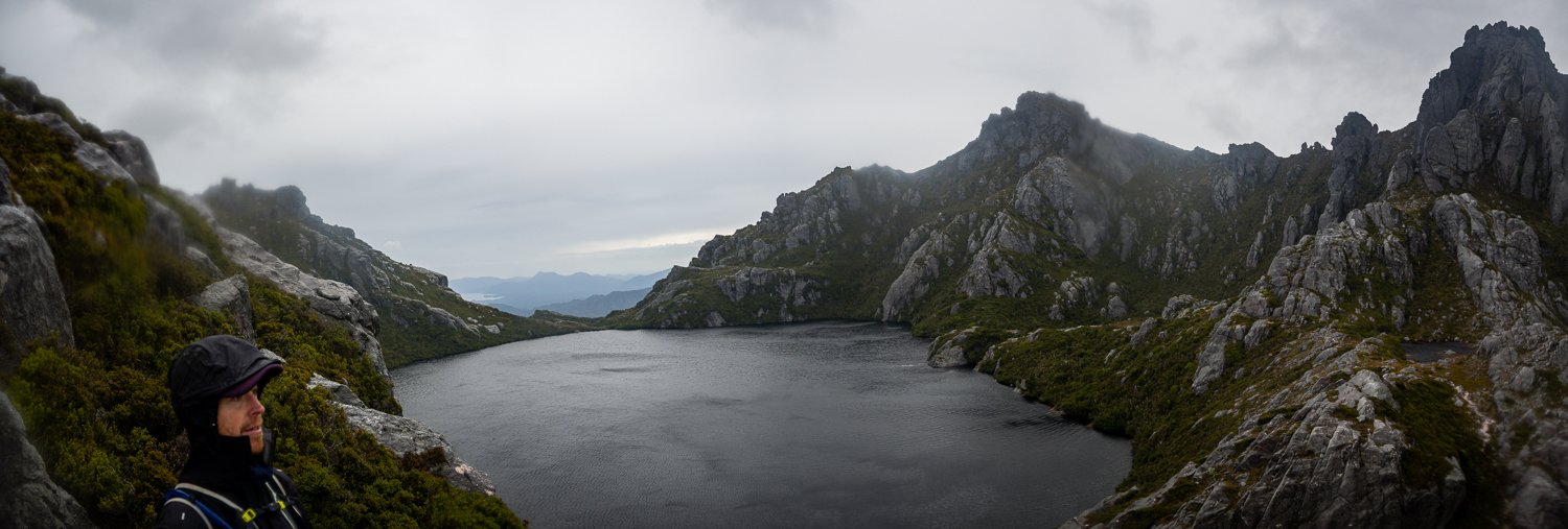
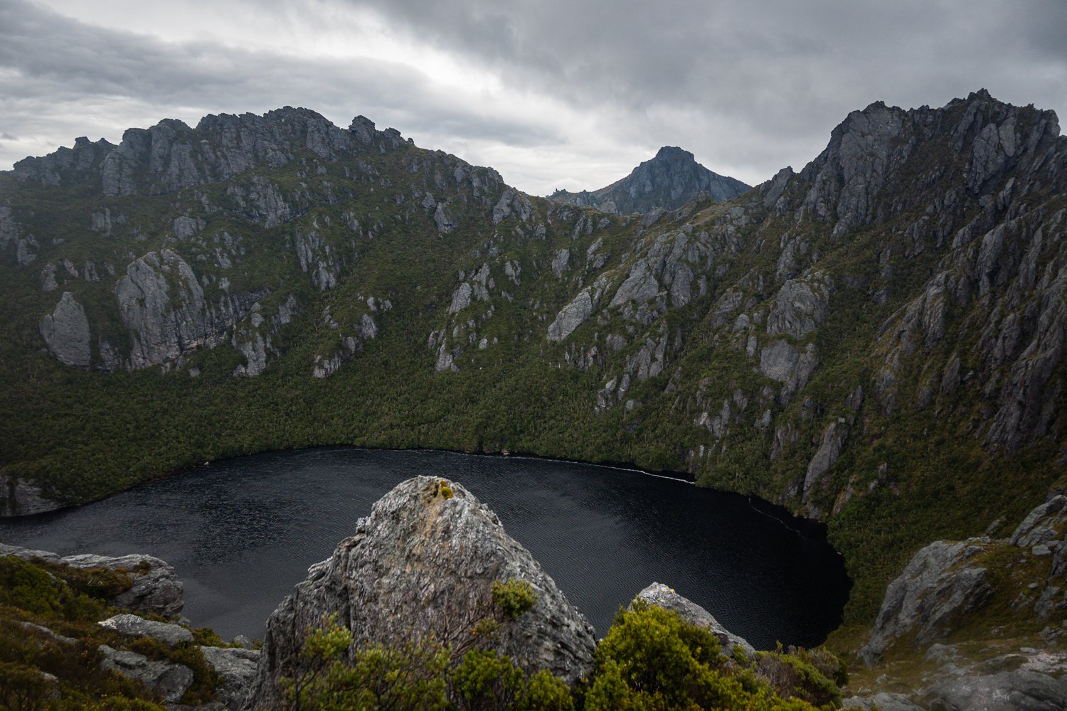
After a nice bit of huff and puff you crest a ridge to behold one of the most spectacular landscapes I have ever witnessed, Lake Oberon, arguably the crown in the Western Arthurs and Tasmania’s southwest. Made famous by the late, great Peter Dombrovskis this crater lake has attracted untold photographers, hikers and nature lovers to gaze upon its beauty.
Looking out over Oberon was the perfect spot for a quick bite to eat and the only rest we had that day, apart from taking pics. A mention goes out to Jon here who, with a completely straight face, pulled out his ‘curried egg’ in white bread sandwich. I won’t go into this but for those of you who know what exercising on empty stomachs can do to your digestion, curried egg is an interesting choice. Well played, Jon.
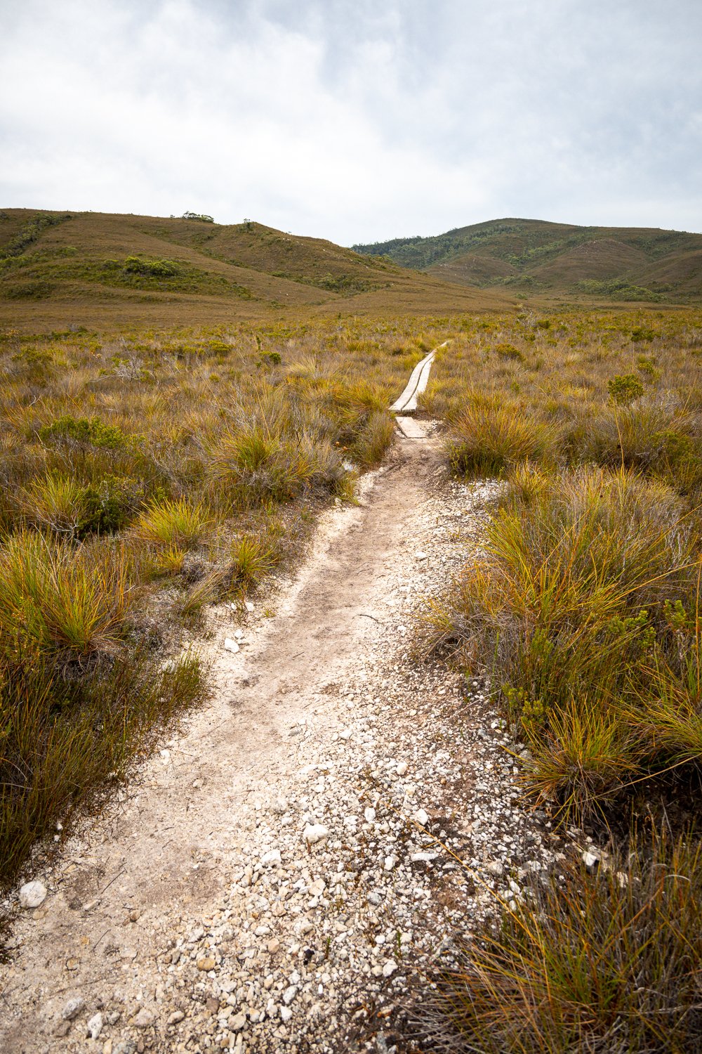
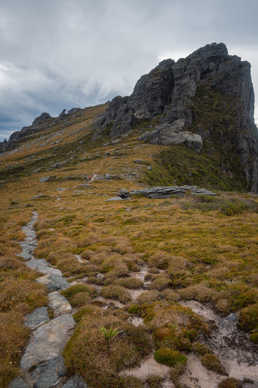
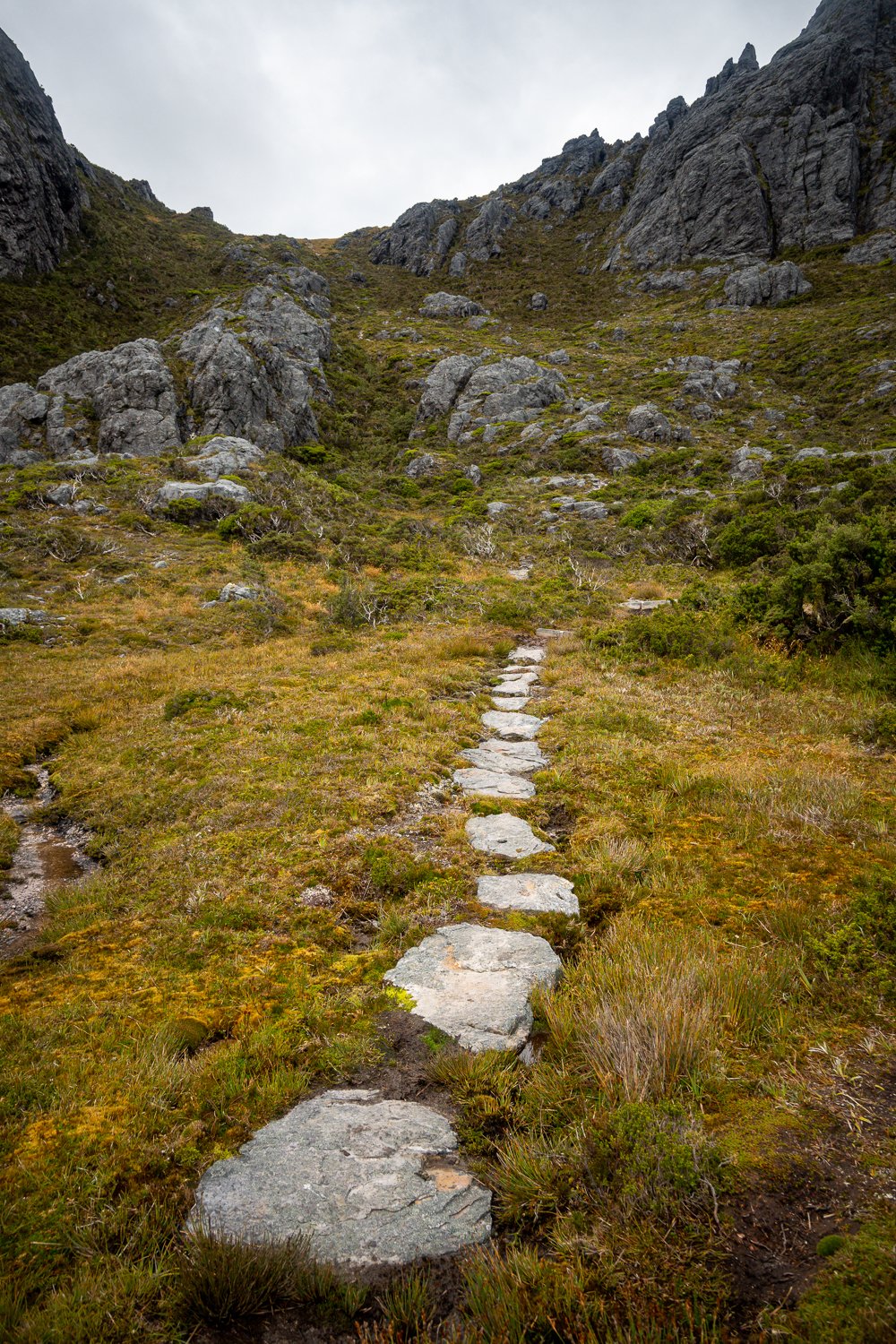
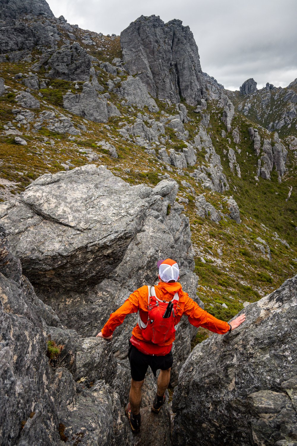
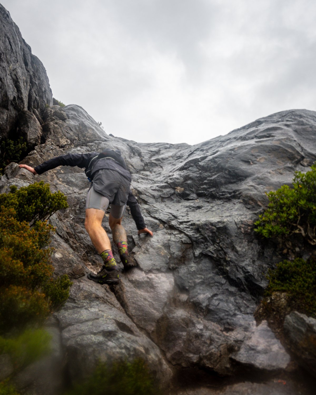
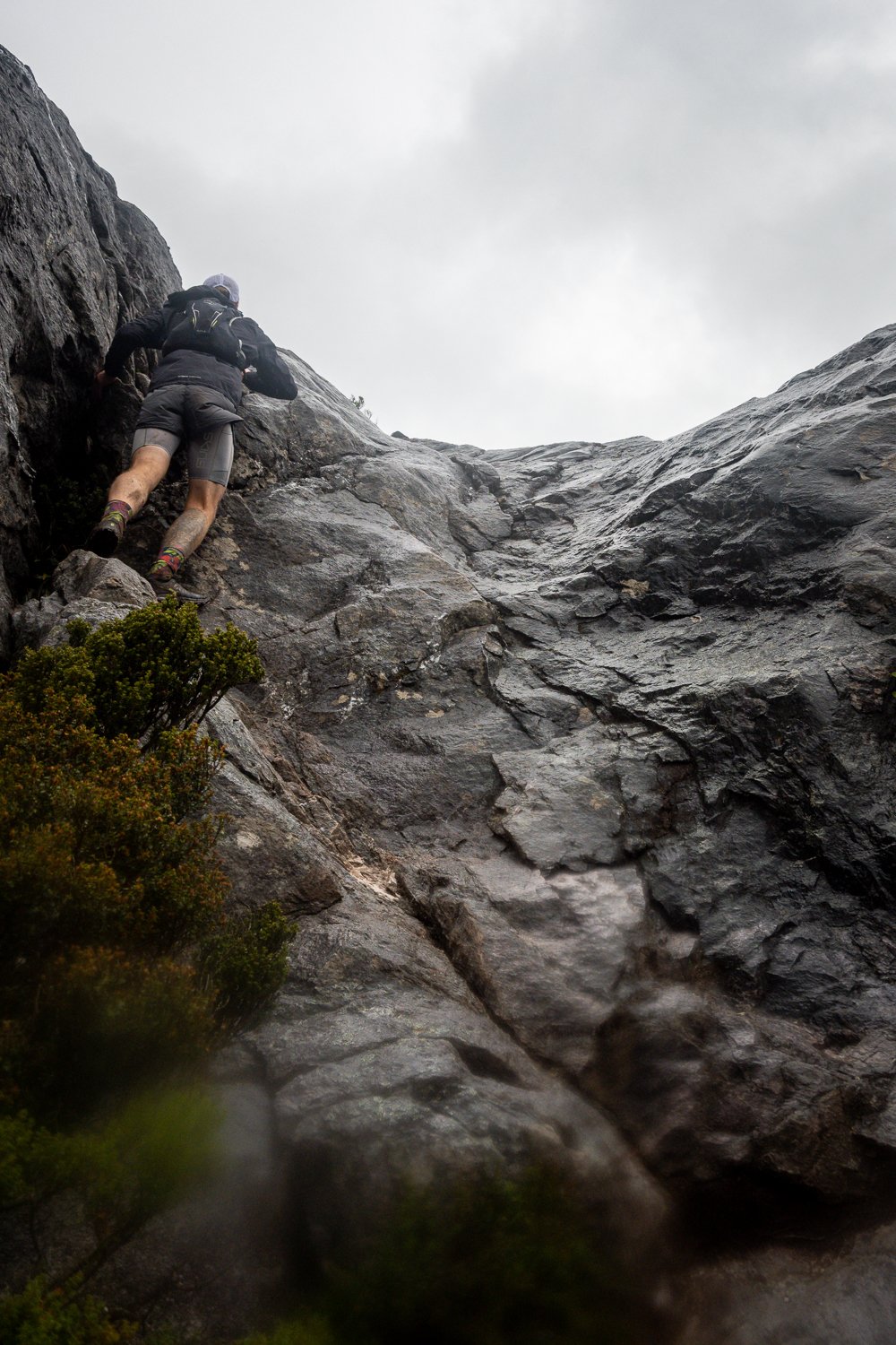
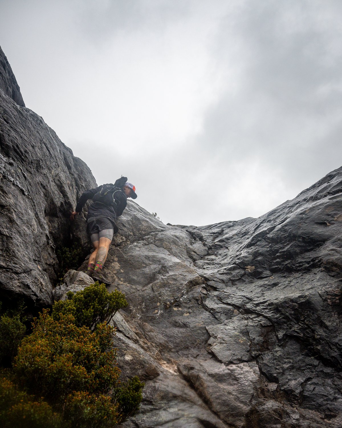
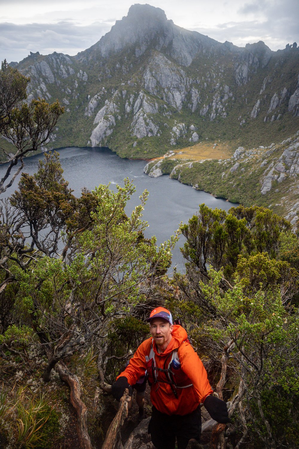
The rain started during lunch and was now coming down sideways in sheets. We soaked in the views but decided to keep moving, the decent into Oberon is a nice little scramble. It sets the tone for what lies ahead and if you struggle on this part of the trip I wouldn’t advise going any further. Once down and onto the trail, which is a beautiful section of duckboard, we kept moving past the camp turnoff and made our way up to the slopes of Mt Pegasus, the first real climb of the day. By now the rain had soaked everything, nothing like a bit of water on quartz slabs to make climbing exposed rock faces a bit more fun!

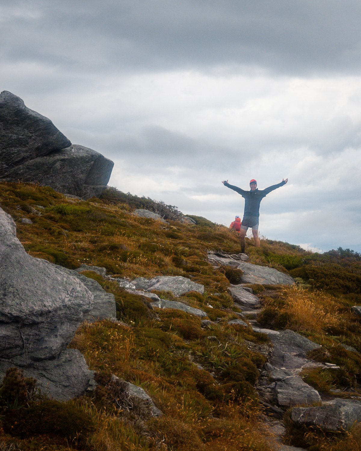
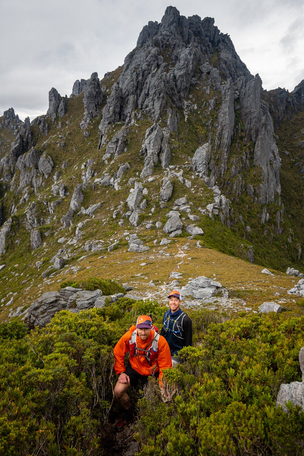
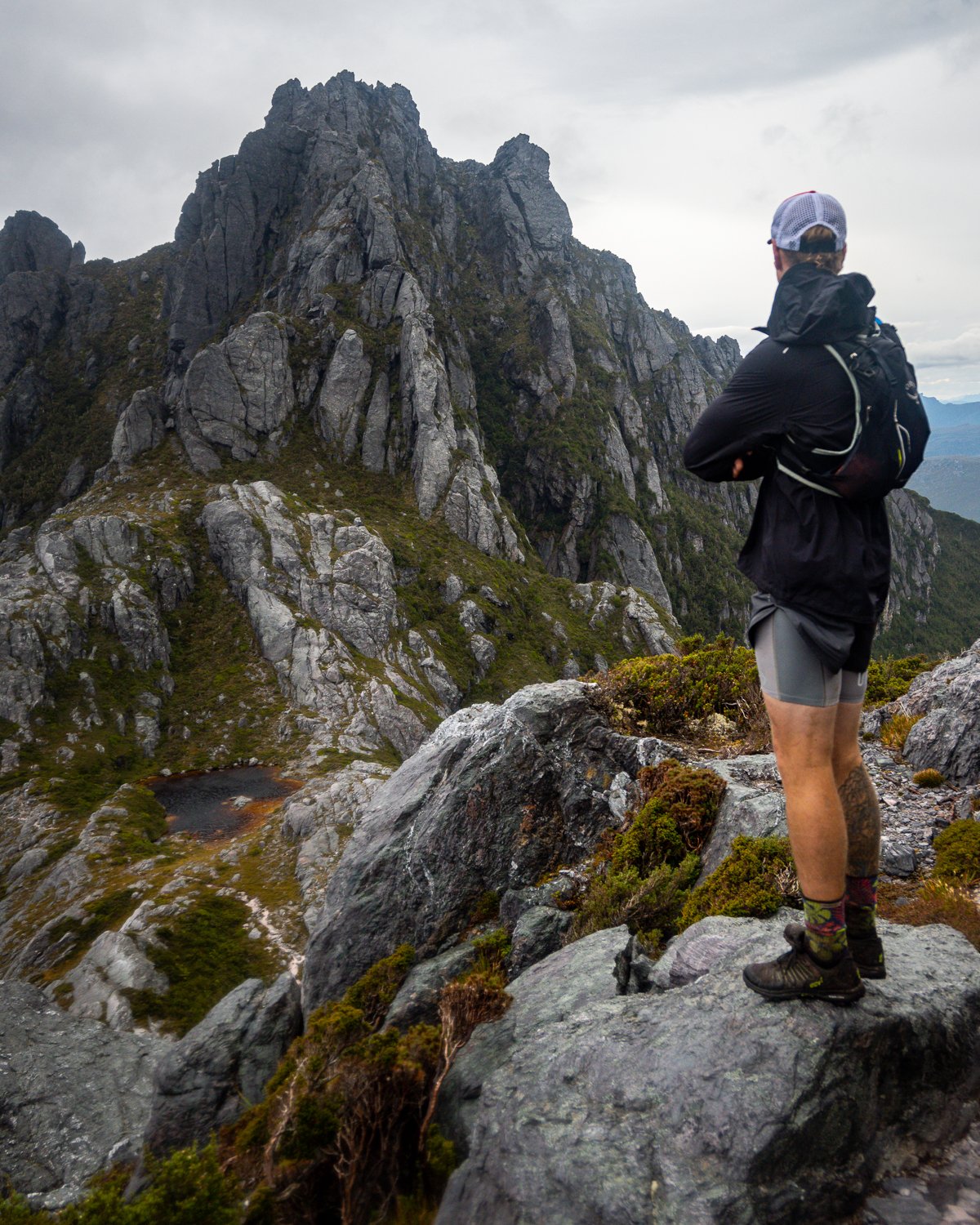
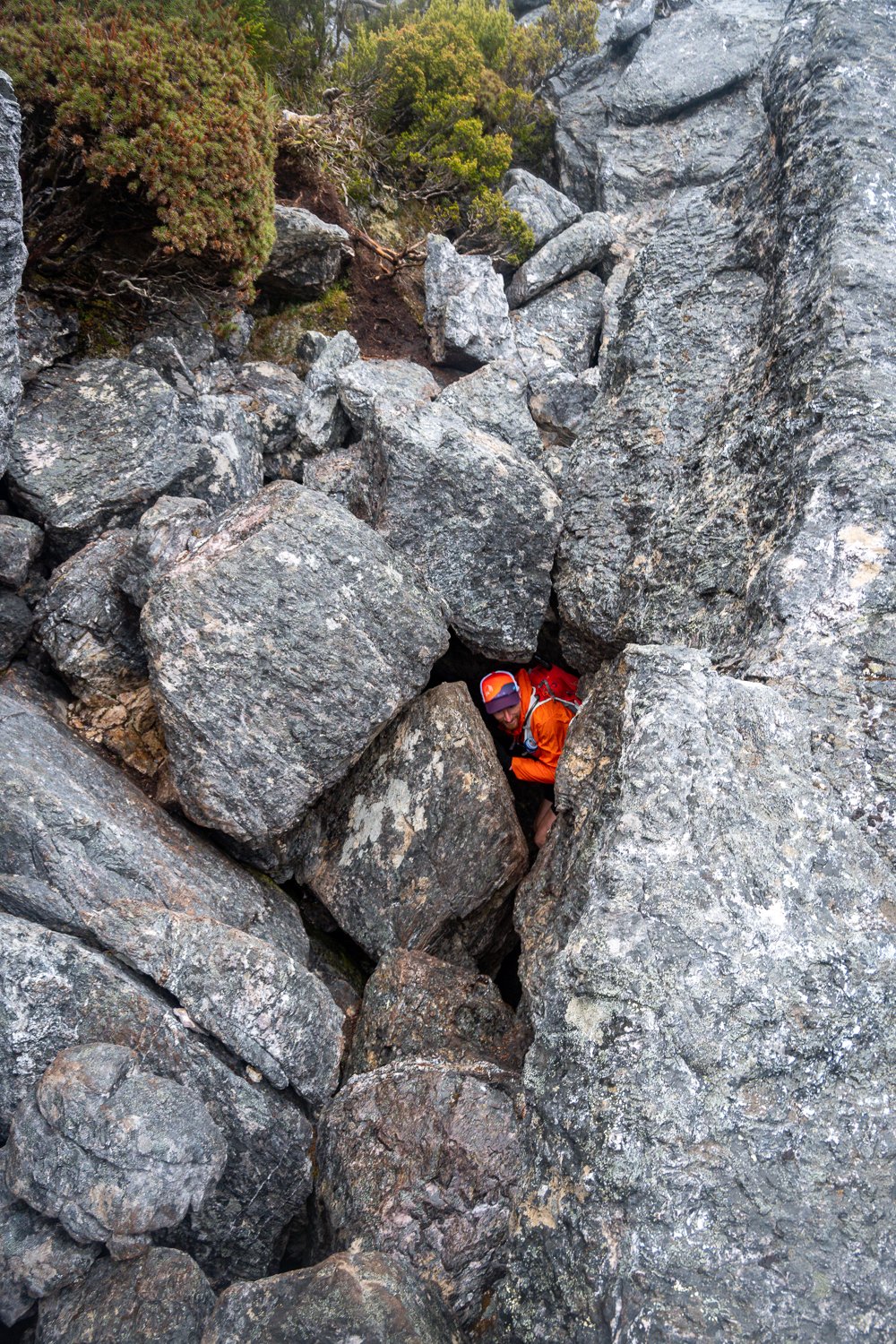
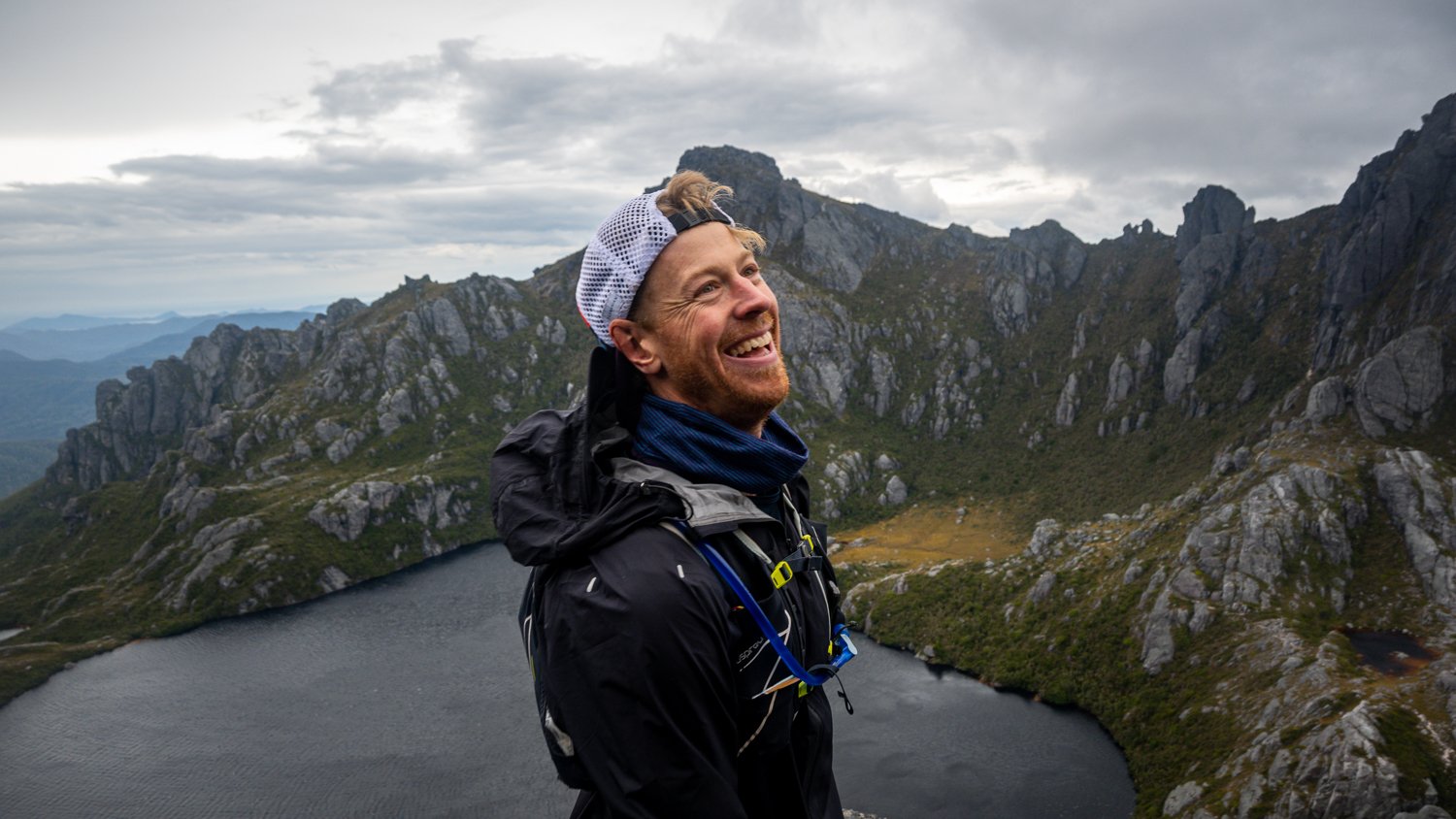
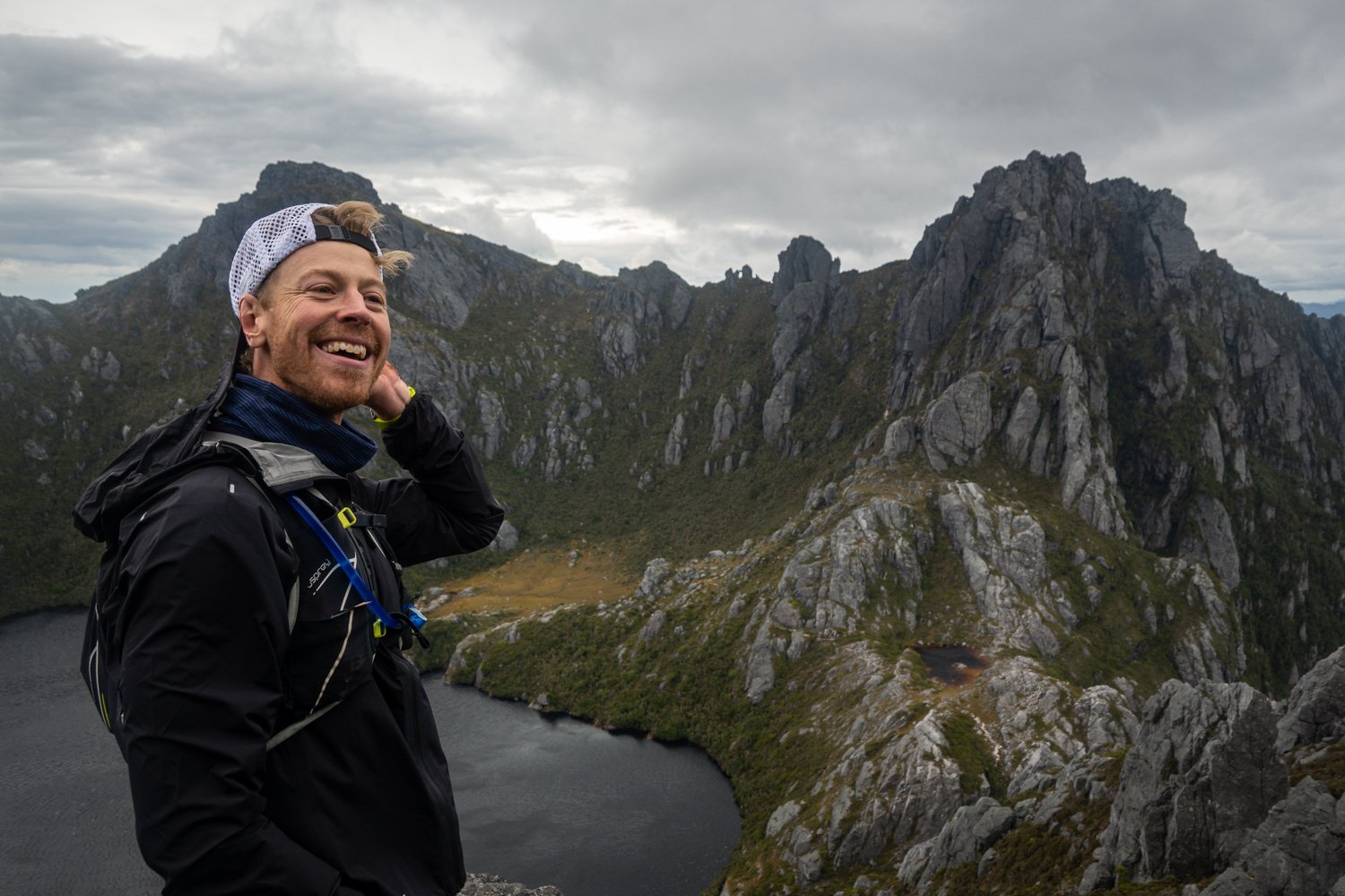
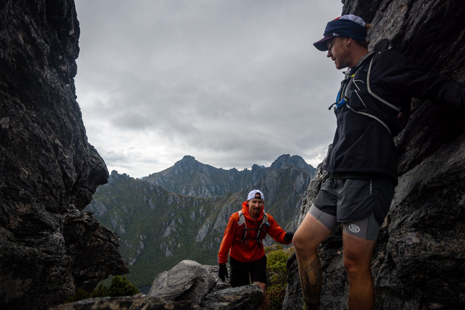
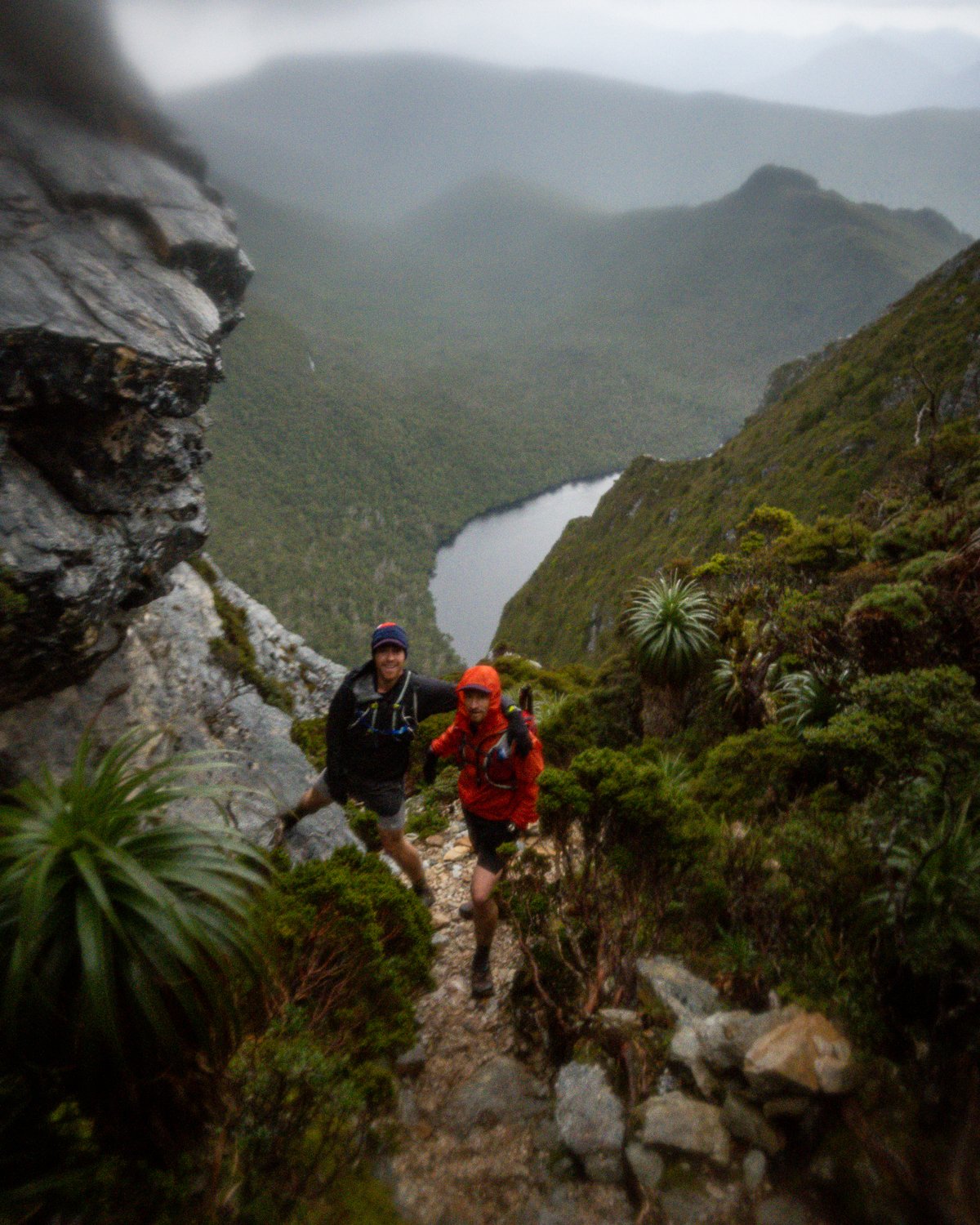
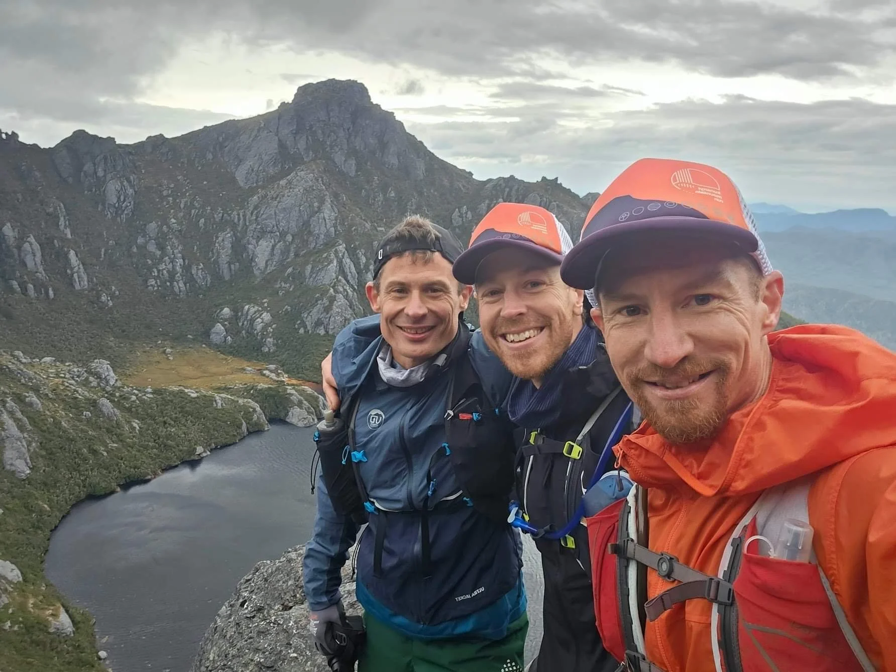
Once you climb Pegasus and poke yourself through the now famous hole in the rock, you are greeted by a reverse view of Oberon. It can’t be explained but it’s fair to say the adrenaline and froth everyone was feeling contributed to the time spent taking pictures and soaking up the experience. There is a spot here that looks out over Oberon and has become fondly know by us as ‘GC Rock’. A few years earlier on our first trip to the range together we captured a memorable shot of us all standing there.
We did the same again and this pic has to be my fav shot of the trip, the look on our faces says it all, FYGC’s.

The GC Running Team!
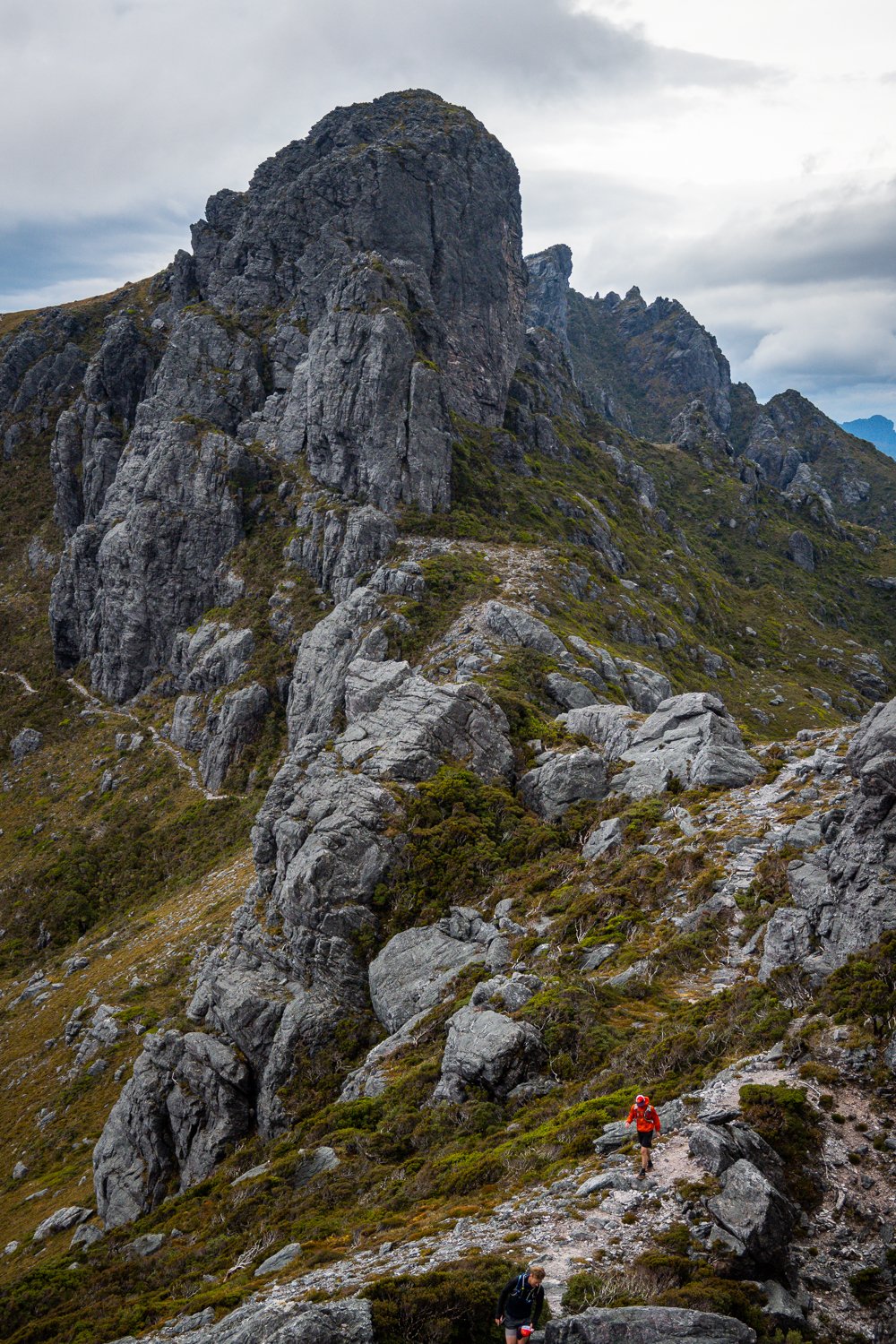
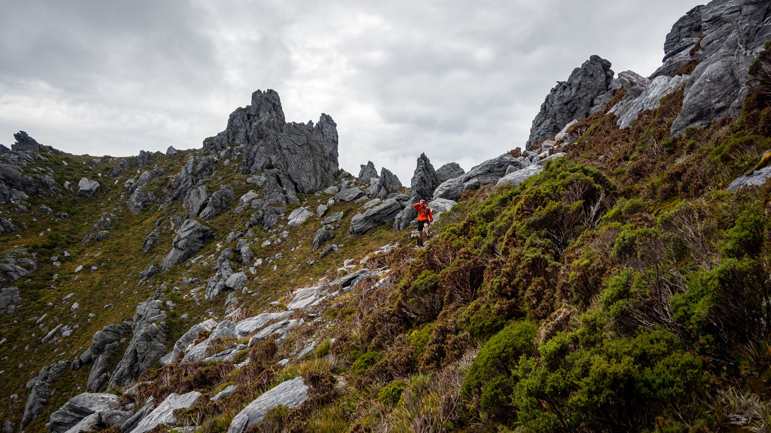
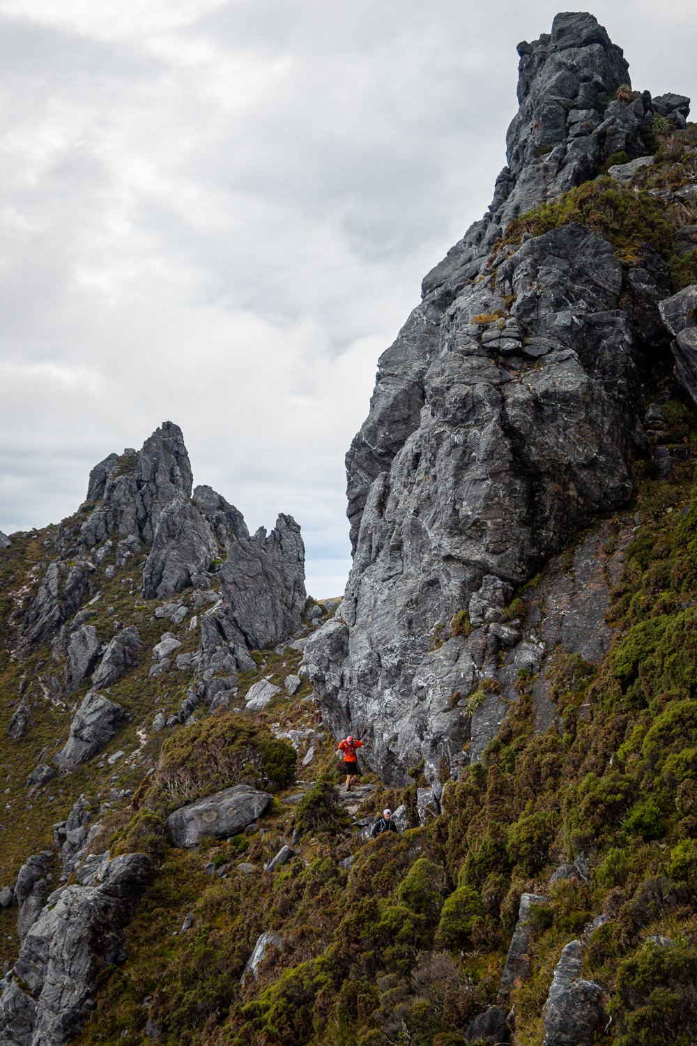
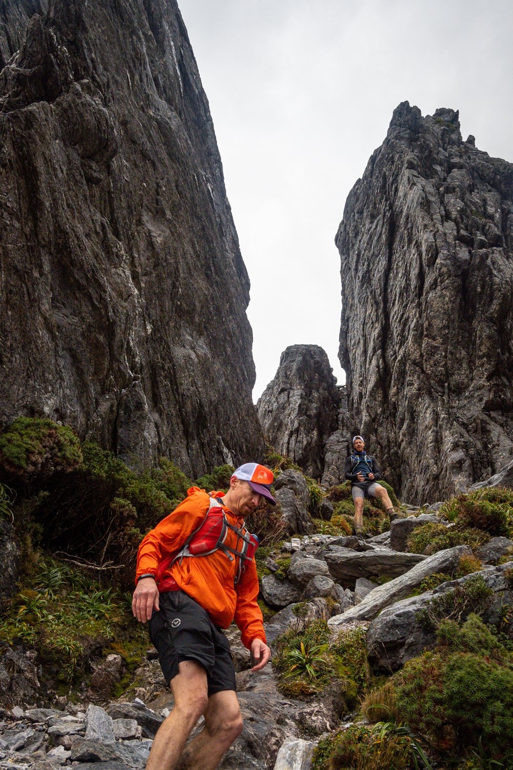
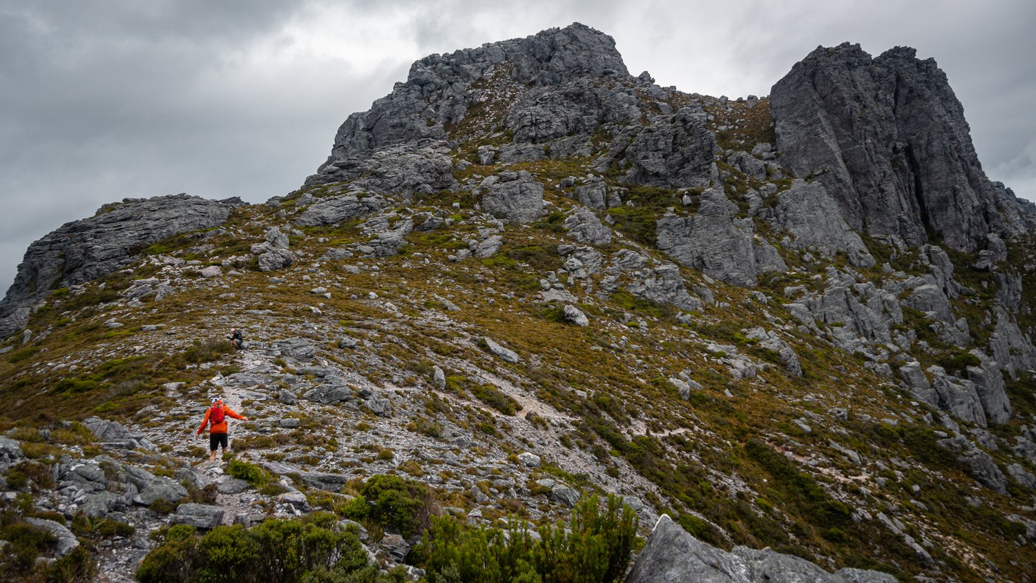
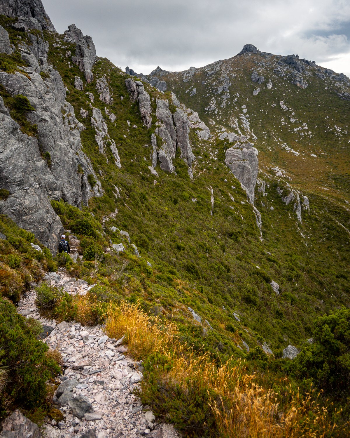
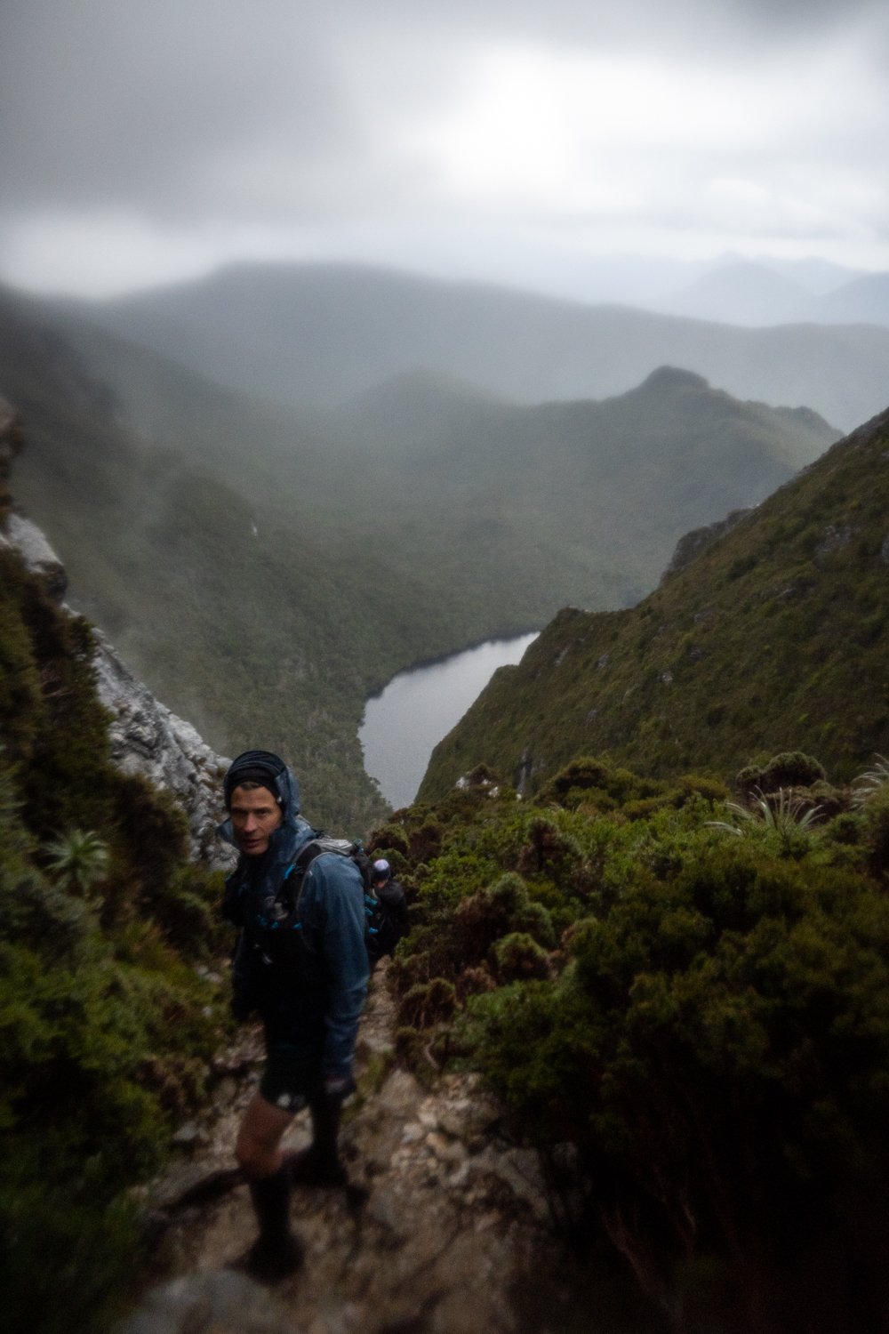
The section from Oberon to High Moor takes a long time. Even though the distance travelled is only +/- 4 km it took 3-4hrs, with a heavy pack on this is a full 8-9+ hr day walk. The physical challenge of it all is easily forgotten by the epic scrambles and sketchy descents that you navigate while admiring the constant views. It has to be one of the best hiking sections I’ve experienced.
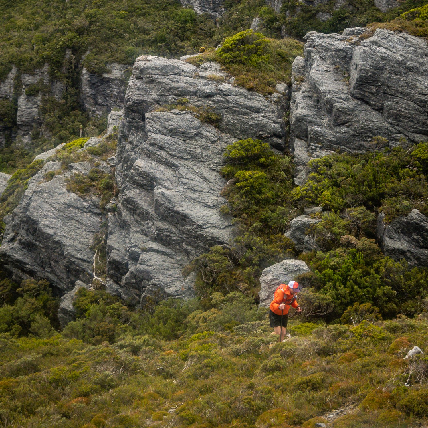
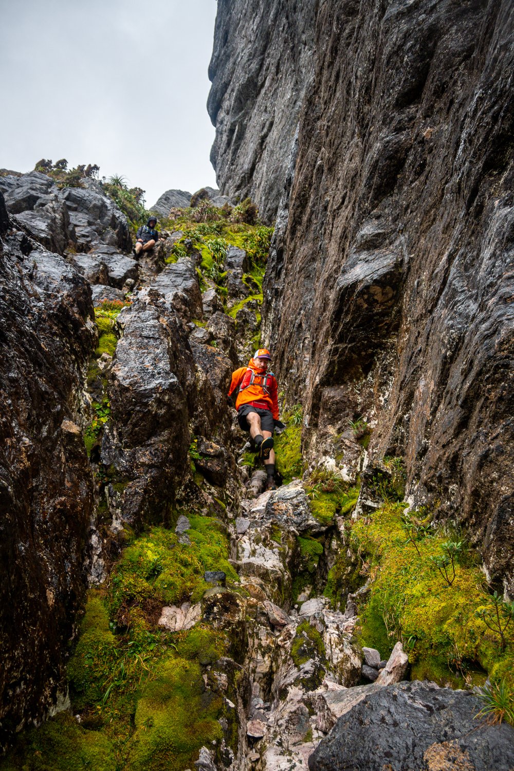
From Pegasus to Capricorn you navigate down white quartzite rock and through dense shrubs filled with mountain pepper-berry, pandani and scoparia. Even though the scoparia tears your skin off their thick limbs are handy to cling to as you lower yourself down the steep descents. It’s a wild experience looking back at the peaks you’ve just come over. The descent from Mt Capricorn is steep and exposed and you basically scale the side of a cliff. Dropping over contorted quartz slabs and creeping down dirt steps, clinging to overhanging branches and rocks we slowly lowered our self down to Mt Capricorn.
The trail on this section can also get a bit tricky to follow, there are a number of side trips and the path forks multiple times. We did have to backtrack and it was very lucky that Jon had the map loaded onto his Garmin. Without this we would have ended up spending the night in our emergency bivvys. I HIGHLY RECCOMEND every person who heads out there has a GPS watch or GPS with the map loaded so you can check your position against the trail regularly.
This is also the stage when the weather started to get a bit nasty, the wind picked up and the rain was getting heavier. Lucky for us we were fairly sheltered from the wind in most sections but the rain was constant and everything was soaked and slippery. It made the going slower but it didn’t dampen our spirits, the wildness of it all made it a bit more adventurous and everyone was in very high spirits.

As a group we have a very close bond that allows us to do these things together. The level of trust and respect that we have built for each other is something that keeps us safe and gets us home. We all love that feeling of being up against the elements, testing yourself, completely out of your comfort zone with nothing you can do except to keep on going.
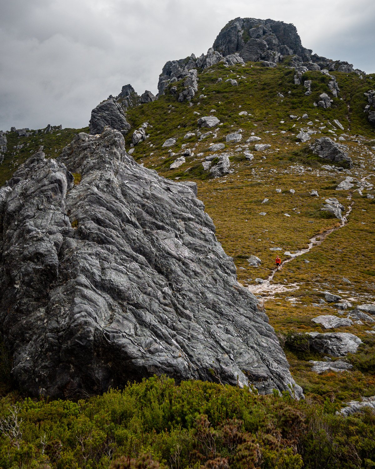
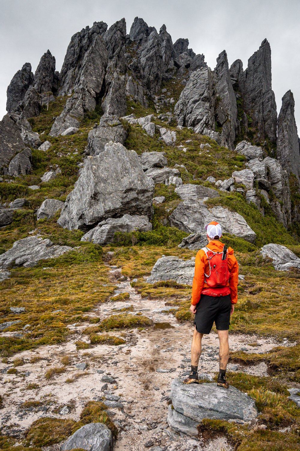
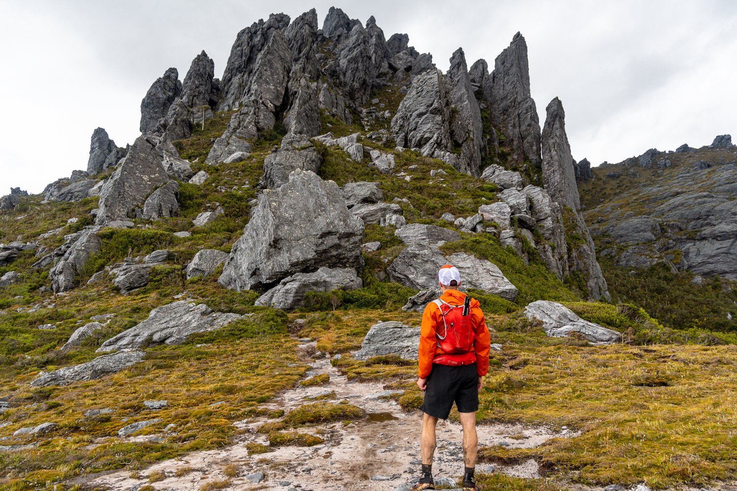
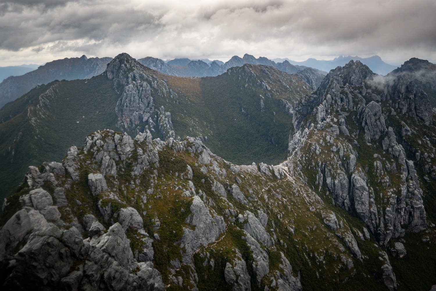
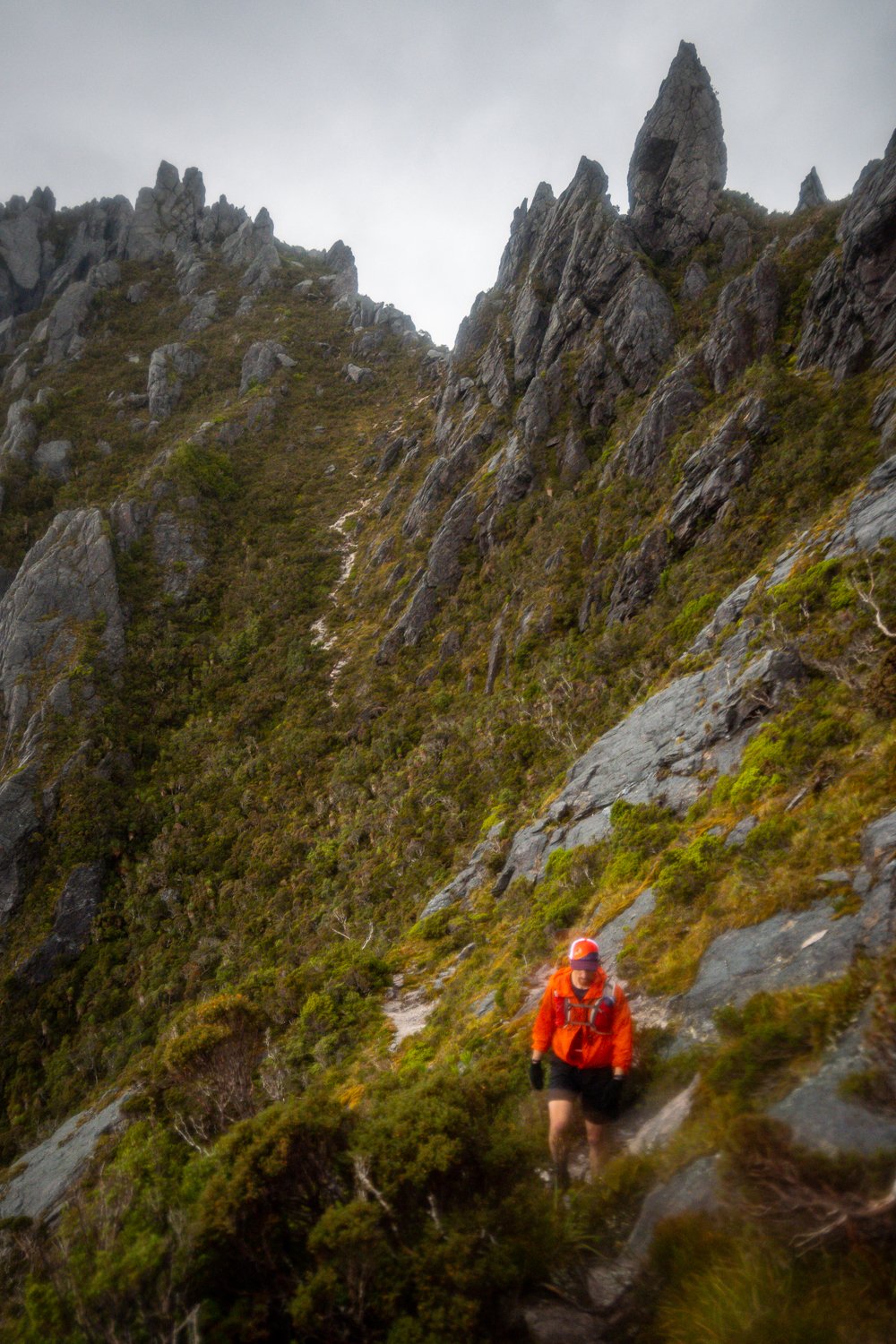
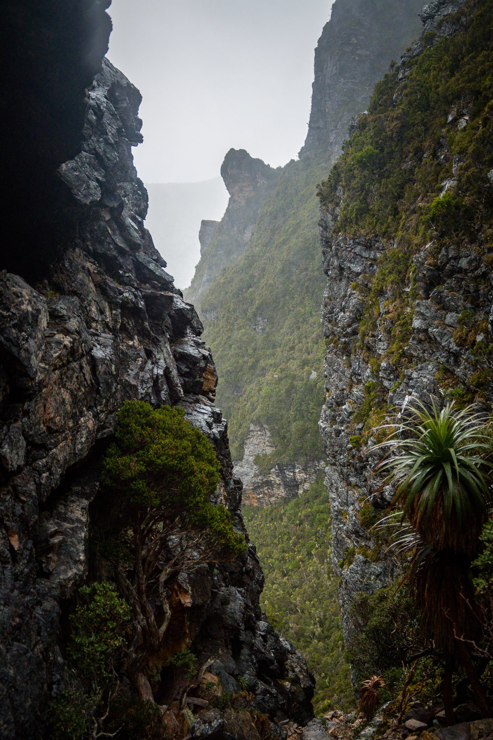
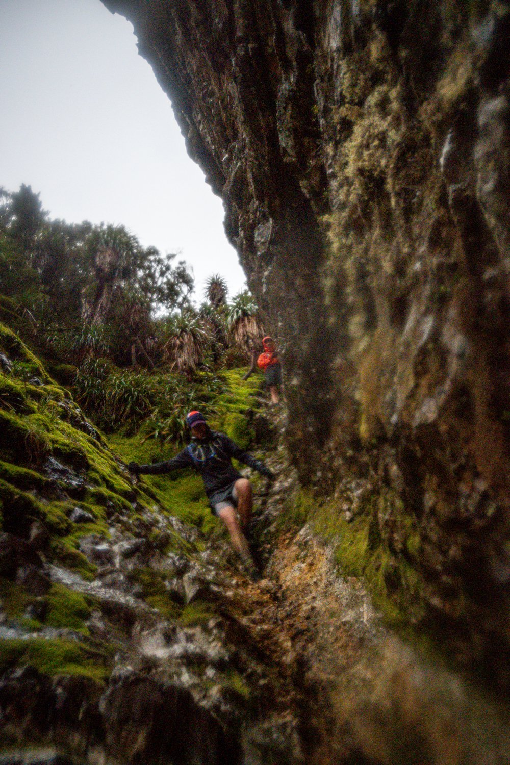
We finally hit High Moor and tbh this isn’t the best of campsites due to the exposure. The wind was brutal and there wasn’t much water. We took what we could and kept moving onto the infamous Beggary Bumps. The Beggary Bumps are a line of precipitous peaks with plunging slopes and damp chasms. Lots of up, down, up, down and at a very slow pace which was made slower in the wet but damn its cool! Emerging from the Bumps we traversed the insanely beautiful mountainside above Lake Ganymede. Horizontal trees cross the path and you have to clamber hand over foot through what feels like ancient Gondwanan forest as you navigate the sheer slope.
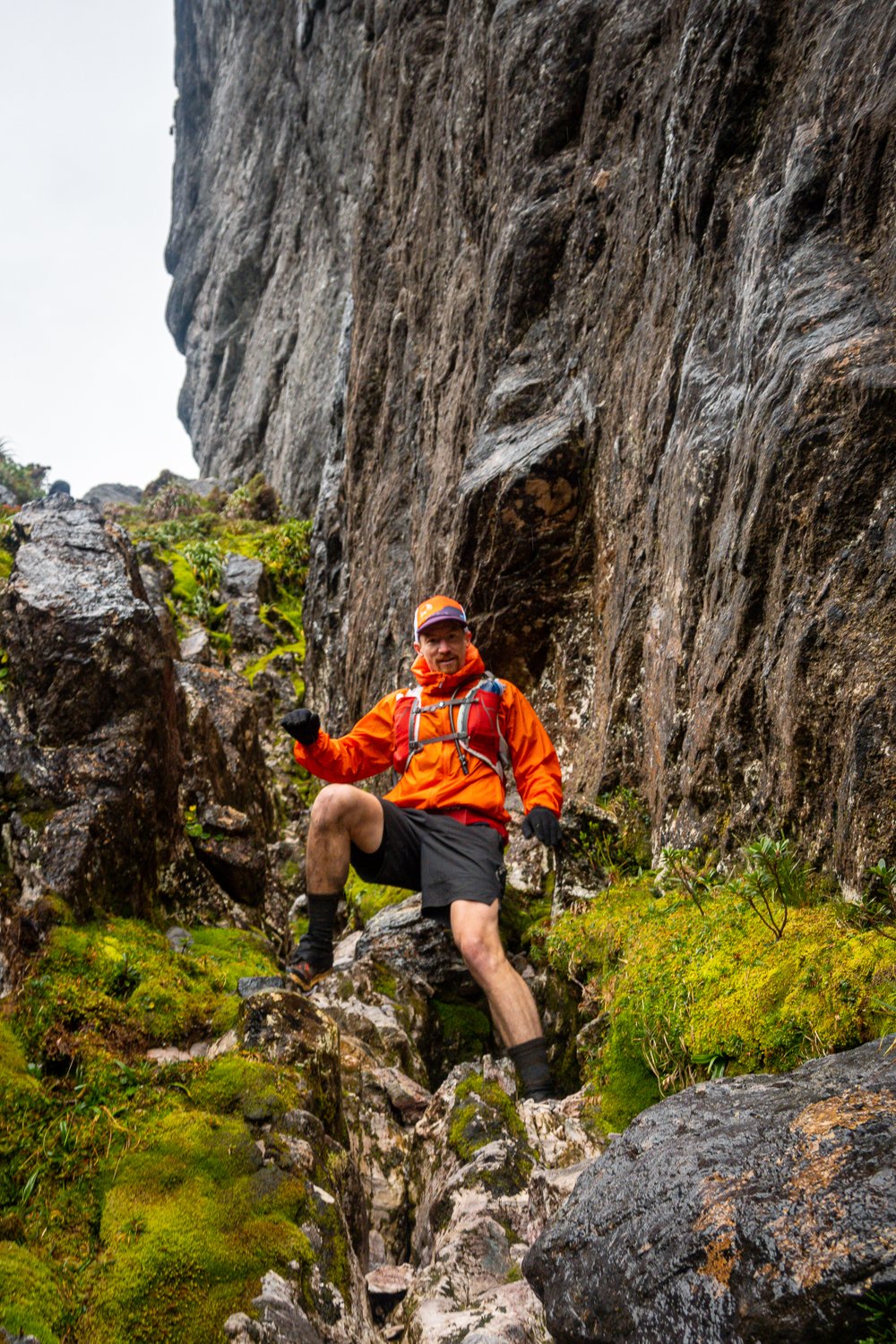
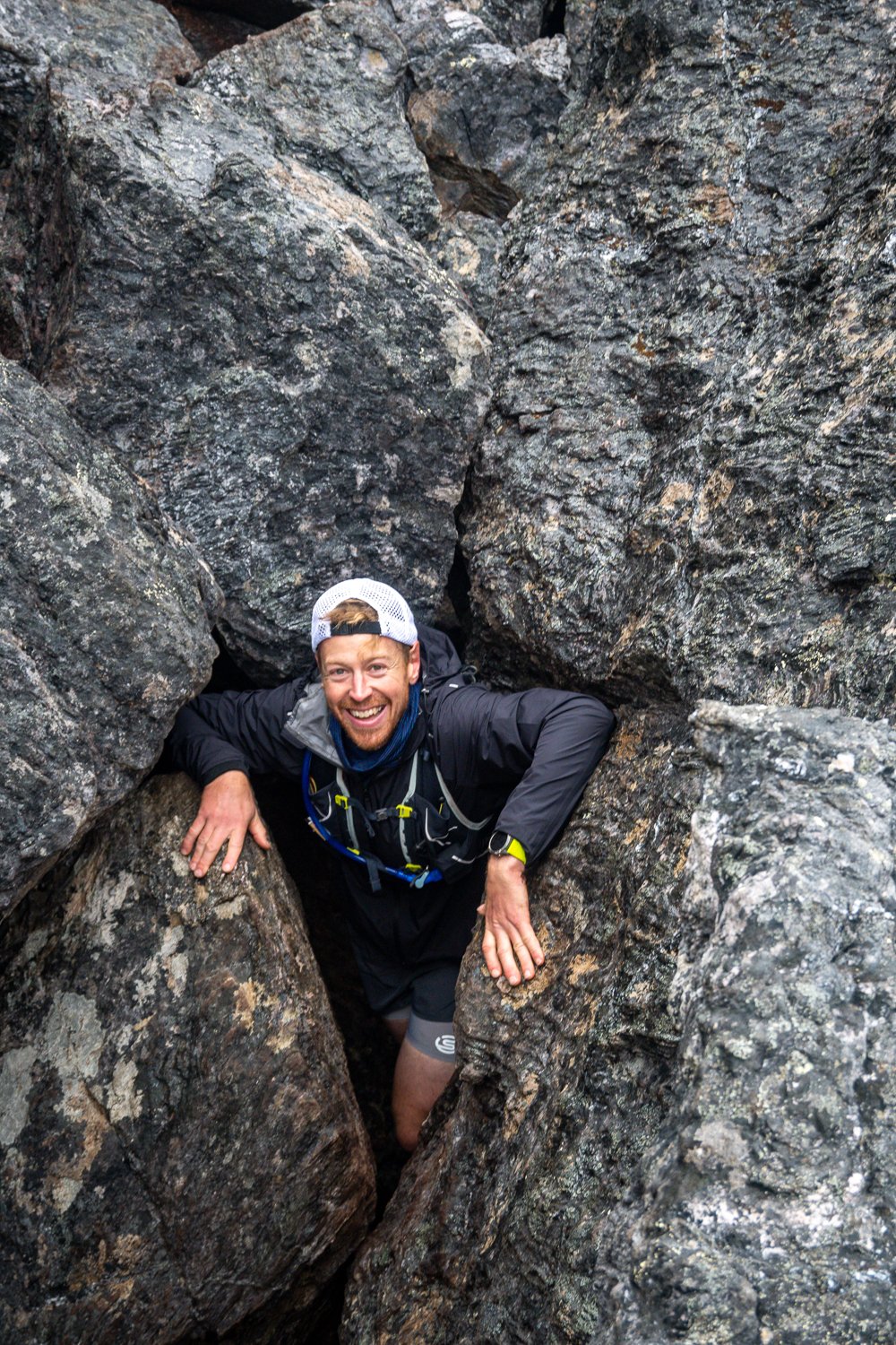
Finally, we arrived at the Tilted Chasm that requires you to slip, slide and shimmy between two massive slanted slabs of damp moss covered granite. I’d been looking forward to this because it’s a wicked experience, if you don’t get a bit of froth on doing this then you can’t be helped. The crew loved it and it’s over way too quick but with the light beginning to fade to we had to keep moving.

Darkness started to creep in and for a while it was pretty cool moving through that terrain during dusk. Darkness finally arrived and it was pitch black, moving through that terrain in the dark is an easy way to injure yourself and collect a free ticket home in the chopper. Luckily the Fenix headtorches we have are THE BOMB!, those things would light up the MCG.
We made it to Mt Taurus and the fading light gave us one last chance to look back to witness the outline of Mt Orion & Sirius with the Beggary Bumps in the foreground, with mention of ‘we just came from there’ we all looked ahead into the dark and said “Let’s Go That Way”. We couldn’t see much from then on in apart from the circular spread of our headtorches. It was bloody wet and slow going but we descend the eastern shoulder of Mt Taurus and the tricky little manoeuvre which required us to drop down between a set of steep, wet boulders before we made the last short section onto Haven Lake.
Haven Lake appeared out of the dark and was our last chance to fill our water bottles, eat some food, swallow a couple of Panadol and vitamin I (Ibuprofen) before we headed off in search of the decent down Kapa Moraine. Again, this is a decent mission in itself and it took us a while, power hiking with regular checks of Jon’s GPS to find the turnoff. Meanwhile the wind blew its ass off and the sideways rain was making everything pretty bloody cold and wet.
Eventually we made it to Kappa Moraine and were on the way down. Down, down, down it goes for around 3km and we actually started to get up a decent pace as the track opened up a little. Somewhere there is a shortcut that saves a few km but we didn’t have this on our map and the risk of trying to find it in the dark was not a great enough reward to save a few k’s. There were no more magical views to help distract us from our sore joints as we methodically moved down the mountain. We did talk at length about how nice the pumpkin soup we had waiting at the carpark would taste, not to mention the bread rolls and BBQ Shapes, it’s amazing how motivational food can be when you’re closing in on the finish of a big mission.
Then we hit the flats of McKay’s track and we were off the range. It was nice to stretch the legs again, spirits were high with the thoughts of a warm pumpkin soup waiting for us back at the car so we set off at a slow jog and made good time for a while.
This is where things got a little tricky, in any mission there can be moments where things have the potential to go wrong. The decisions made are crucial to your safety and ultimately it can come down to experience, how tired you are and a little bit of luck, good or bad…

We were all wearing decent GPS watches with track back features and Jon had the route loaded onto his watch. The problem was that on the way back to Junction Creek you have to navigate through a number of small forests, in the dark these were spooky as fuck and the canopy cover cause the GPS to do weird things. What we later found out is that we got turned around and went back the way we had come, this resulted in an extra 7ish km. There was a moment when we arrived at a spot that felt familiar and I asked the question if we had been there before because it felt very familiar, in the dark this was definitely unnerving but I trust Jon wholeheartedly and he double checked things and set us on the right path, back the way we had come, which ultimately led to us getting home.
Note - this was not Jon’s fault, he probably feels responsible BUT the fact of the matter is he navigated us through the whole trip which is a huge responsibility. Francois and I relied on him to get us home, he did just that and with a calm head. Nether Francois or I questioned him at any time because I didnt even have the map loaded on my watch, Lesson #2, and we trust his skills. What it does demonstrate is that you have to keep calm, trust in the people you are with and realise that shit can go wrong, it’s how you deal with it that matters. Jon dealt with it in the way that makes me love and appreciate him, he kept calm and got shit done.
The next challenge we were presented with was my head torch running out of battery. I noticed this starting to happen and realised I didn’t have a spare battery, big mistake, Lesson #3. Normally I have a spare battery and headtorch but due to recent races I changed my emergency pack and had not repacked properly. The other guys had good battery left so we dimmed down their lights, put me in the middle and I turned off my headtorch until we got to Junction Creek. It was a pretty shit experience and meant a lot of slipping, sliding, slowing down pace and with the additional 7k you can imagine what it did for my patience. However, we kept calm and motored on. That’s what I get for leaving the spare battery at home, won’t do that again will I haha 😂

Next the rain and wind picked up ferocity. It got really cold and we all started shivering, this is when it could have become quite dangerous if we weren’t as fit as fiddles and aware of what was happening. We tried to move for a while but it got worse and as one who knows what hypothermia can feel like I called a stop so I could put my emergency thermal top, beanie and neck warmer on. It was a pretty quiet moment amongst us all as we stood in the rain getting changed. If your body temp drops, you get confused and can’t move properly, if you get hypo then you’re in a chopper and none of us want that on our resume thanks. It would be a long cold wait and is not something that you ever want to happen, we all knew the reality of this so picked up the pace to keep warm.
Then Jon’s watch hit 7% battery, ha-ha… Lesson #4. It felt like things were trying their best to go wrong, but what I appreciate about our group is that nothing was said, we just kept focused on the task at hand and kept moving. I have to admit that I started looking for the solution if our headtorches ran out and Jon’s GPS died. In the cold dark of night in SW Tasmania, that would have been an interesting challenge to overcome. We had emergency bivvies and could have buckled down for a couple of hours till daylight, it would have sucked but we were prepared

Finally we arrived at Junction Creek. If the people camped there were awake they would have heard “Thank fuck for that!” as we arrived. It was a heartfelt sentiment and quite a relief, we all knew it was only another 10km of knee deep mud pits in the dark. It was at this point Francois pulled out the secret Mars and Snickers bars he had hidden in his backpack. Jon and I were in disbelief and joy, I can’t explain to you how good those bad boys tasted as we stood there in the dark savouring every moment of pleasure the chocolate, caramel and nuts provided. I was impressed by his forethought and have to forgive him for the massive fart he did in my face as I climbed up a ridge close behind him earlier that day. Well played Mr. Fourie.
I guess a note should go in about the musical tones our bodies played throughout the day, if you go on adventures or long-distance activities you will know what the lack of solids and increased sugar based fuel does to your gut. The fart song we sang that day was impressive, not to mention Jon’s curried bloody egg sandwich. It sounds weird to note it but if this is to be a true account of the day, the symphony of the sphincter needs to be mentioned.
The last 10km were tough, there’s no doubt about it and I won’t sugar coat it. The mud was relentless, knee high, thick and deep. It was really dark and I used the last of my headtorches’ battery to get me home. My quads had given up which meant I kept slipping in the mud and faceplanted a few times. It’s probably the only time throughout the experience I got fairly shitty with the situation but knowing the finish line was close kept us all going.
The moment to finish arrived, we hit the foot washing station and burst out into the carpark with TFFT! We signed out of the log book and the first thing on my mind was pumpkin soup, however when Francois advised us all that it 4:45am those plan went out the window. My wife is very supportive of what I do and always does everything she can to help me take on these crazy missions. One thing I always do in return is let her know when I will be returning and make sure to send a message letting her know I am safe. Unfortunately, we took a fair bit longer than expected so my message was overdue and I didn’t want her to be stressing. Thanks to the lads who were happy to set off in search of reception so I could send my message.
There were still the cravings to deal with and the first thing I did after opening the car was rip open the box of Arnott’s cheese and bacon shapes I had waiting for me. I’d been thinking about those for ages and didn’t waste time trying to eat politely. I stuffed them in my face with a sigh of relief and handed them round the team. Jon mentioned afterwards that he will never look at a box of them the same again. I’m sure that in many years to come I’ll see a packet of them and I will be transported back to that moment. Jon also had a packet of salted potato chips which will also bring me fond memories every time I walk past them in the supermarket.

This adventure was an amazing experience that I will cherish for the rest of my life. I feel very fortunate to live in a country where not only I can access these sorts of areas, but I am privileged enough to lead a life that allows me to train, eat, sleep and live a lifestyle that supports it. Big thanks to Jon and Francois for being dead set legends, having good mates that you can not only go on adventures with but also trust that if you end up doing yourself a mischief you can trust in the team you're with to get you home.
Most importantly though is the fact I am privileged and blessed to have a wife and family who support me on my crazy adventures. The last and most important sign of thanks goes to my wifey, thank toots xxoo LULTUISNAMB4EVAMAN.
Summary - Overall my Garmin tells me that we travelled 69.49 km over 21:24:26 with 4,290m of elevation gain. My avg HR was 134bpm, I burned around 8500 calories and the highest elevation/peak was 1,105m. A big day….
Lessons Learnt
Lesson 1 - Set multiple alarms so you don’t miss any daylight or an epic sunrise.
Lesson 2 - Always load the map on each persons watch or device.
Lesson 3 - Carry spare power sources for safety equipment like headtorches, phones watches etc.
Lesson 4 - To save battery on your Garmin watch or tracking device keep one as a backup and have two people check directions regularly to dbl check you’re going the right way.
Leson 5 - If you are tackling big missions that come with an element of danger, make sure you have a lot of trust in the people you are doing it with. We all deal with things in different ways and that’s ok, but if it came down to it do you trust the person you're with to; a) save your life if required or b) have the capability to keep their shit together in the hard times and make good decisions that ultimately lead to you safe arrival home.
Equipment - Here’s what I used. It kept me comfortable and helped me get home safely.
Raincoat - Ultimate Direction Ultra Jacket - This was the first time I really put this to the test apart from local runs in the rain. Waterproof and breathable with 30,000g/m2/24hr moisture vapor transmission rate and 30,000mm water entry pressure, it did exactly what it was supposed to. I stayed dry for the most part. When the rain got really heavy I started to get a little wet but it breathed well and the seal around my face was nice and tight. The only thing about it is there are no pockets and the little hand mitten things are weird!
Pack - Ultimate Direction Mountain Vest 6.0 - This thing is great for the longer trips. It carries a heap of gear and is very comfortable, the water bottle has the snap lock function that enables them to close and stops leakage which I found super important.
Shoes - Inov8 Trailrock 275’s - Inov8 are a damn fine shoe company and bloody hell these shoes are tough. I don’t know what Graphene is but if it can withstand the rocky terrain of Western Arthur’s then it’s gotta be good. The pair I wore had over 1000klm of use and still performed extremely well.
Fuel - Bulk Nutrients powders in my water, CLIF Bars & Bloks for energy.
Running Belt - Naked Running Band - I love this thing, it holds all my fuel powders around my waist and reduces the weight hanging off my shoulders. There’s no bouncing and it feel’s comfortable, I use it on all my longer adventures and regularly when I need to carry more than just my phone.
Shorts - T8 Sherpa’s, they’re so damn light and come with the extra waist pockets for those little things like GoPro batteries..
Socks - Injinji toe socks - once you try them you never go back. They feel a bit weird at first but I had wet feet most of the day without a hint of a blister which is super important for those longer and remote adventures.
Gaiters - Moxie Gear Shin & Ankle Gaiters - You wouldn’t beleive how much the combo of these two helped. Bashing through Tassie scrub is tough on the equipment, let alone your skin. Plants like scoparia have very sharp foliage and the continual rubbing against rocks, scrub and everything else would have taken layers off my shins that normal scrub socks couldn’t handle. The Shin Gaiters have padded panels over the shin with reflective cords for night visibility, and soft stretch fabric around the calf which gives a perfect fit. Perfect for outdoor adventures and use in the Tassie bush.
Gloves - Bunnings gardening gloves, haha! So good for climbing but not the best for warmth.
Beanie - Headsox - I’ve been using a lightweight merino beanie from this company for years. It’s small, warm & perfect!
Camera - Nikon Z50, strapped to my hand this was a great addition to the trip. High quality pics and so easy to use, it handles daytime light really well with a 20.9MP sensor. It’s small nimble and perfect for those who want more than a phone to capture their images.
Top - Arcteryx thermal, lightweight, warm and wicks like a dream.
Head Torch - Fenix HM65-R-T - A fantastic headtorch for trail running the headbands tightening system and 1500 lumens is great and I really like this piece of kit. Just pack a spare battery ;)